Argentina / Salta
Salar de Pastos Grandes
Salar de Pastos Grandes is an inland beach, 53.6 km west of La Poma (Salta, Argentina). Average daytime highs peak at 17 °C in December and drop to 6 °C in July.
Weather month by month
November at Salar de Pastos Grandes
Beach-day index 4.4/10 · Argentina median 4.1
| Measure | Jan | Feb | Mar | Apr | May | Jun | Jul | Aug | Sep | Oct | Nov | Dec |
|---|---|---|---|---|---|---|---|---|---|---|---|---|
| High °C | 15° | 14° | 14° | 11° | 7° | 6° | 6° | 8° | 11° | 15° | 17° | 17° |
| Low °C | 0° | -0° | -2° | -5° | -7° | -8° | -8° | -7° | -6° | -5° | -3° | -1° |
| Rain mm | 173 | 155 | 112 | 52 | 11 | 4 | 2 | 3 | 4 | 27 | 57 | 136 |
| Cloud % | 47 | 42 | 25 | 19 | 21 | 26 | 25 | 20 | 18 | 20 | 22 | 32 |
| Wind m/s | 2.6 | 2.5 | 2.7 | 3.8 | 5.4 | 6.2 | 6.5 | 6.1 | 6.0 | 5.0 | 4.0 | 3.1 |
| Daylight h | 13.5 | 12.9 | 12.3 | 11.5 | 10.9 | 10.6 | 10.7 | 11.2 | 11.9 | 12.6 | 13.3 | 13.7 |
| Record high/low | 21°/-7° | 21°/-8° | 19°/-13° | 18°/-9° | 15°/-13° | 15°/-18° | 14°/-17° | 17°/-14° | 19°/-12° | 21°/-10° | 23°/-12° | 22°/-10° |
| Beach index | 2.8 | 3.1 | 3.8 | 4.5 | 4.6 | 4.4 | 4.4 | 4.6 | 4.6 | 4.5 | 4.4 | 3.4 |
Long-term monthly averages: air from NASA POWER (2001–2020), sea from NOAA OISST (1991–2020); records are the extremes of 2001–2020. How the index works.
Setting
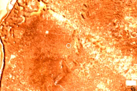
Within 1 km, the land is 100% bare ground, sand or rock (satellite land-cover map, 2021): open dunes, sand or rock.
- Bare 100%
Land cover: ESA WorldCover 2021 (10 m).
This is not a sea beach, so no sea-temperature normals are shown.
When to go
No month reaches 5.5 on the beach-day index; the best is May at 4.6/10, held back mainly by cool air (highs of 7 °C).
January is the wettest month (173 mm) and July the driest (2 mm); the yearly total is about 740 mm.
Daylight runs from 10.6 hours in June to 13.7 hours in December; in mid-May the sun rises at 07:54 and sets at 18:51 local time.
Getting there
| Airport | Code | Distance | Direction |
|---|---|---|---|
| Martín Miguel de Güemes International Airport Salta | SLA | 127 km | east |
| Gobernador Horacio Guzman International Airport San Salvador de Jujuy | JUJ | 166 km | east |
| Teniente Benjamín Matienzo International Airport San Miguel de Tucumán | TUC | 295 km | south-east |
Straight-line distances from the beach; road distance is usually 20–40% longer.
Reference
Salar de Pastos Grandes has an article on the FR Wikipedia: Salar de Pastos Grandes.
Wikidata item Q3469630 · classified as salt pan.
Map
Loading map…
Data on this page
- Air temperature, rain, cloud, wind, humidity: NASA POWER climatology 2001–2020, 0.5° grid.
- Water body, status and length: Wikidata (CC0).
- Towns and time zone: GeoNames (CC BY 4.0). Airports: OurAirports (public domain). Sunrise and sunset: NOAA solar equations.
- Satellite view: Copernicus Sentinel-2 (ESA), scene S2A_19JGN_20260411_0_L2A.
- Settlements: GeoNames places with 1,000+ inhabitants.
- Land cover: ESA WorldCover 2021, 10 m (CC BY 4.0).
Data compiled 2026-10-13. Something wrong? Report a data error.