Australia / Victoria
Wild Dog Shore
Wild Dog Shore is a beach, 22.4 km east of Longford (Victoria, Australia). The sea averages 19.0 °C in February, its warmest month, and 12.4 °C in August; it never reaches 21 °C on average.
Average sea surface temperature by month. Current month outlined.
Month by month
November at Wild Dog Shore
Beach-day index 4.7/10 · Australia median 5.7
| Measure | Jan | Feb | Mar | Apr | May | Jun | Jul | Aug | Sep | Oct | Nov | Dec |
|---|---|---|---|---|---|---|---|---|---|---|---|---|
| Sea °C | 18.5 °C | 19.0 °C | 18.4 °C | 17.2 °C | 15.8 °C | 14.3 °C | 13.1 °C | 12.4 °C | 12.7 °C | 13.8 °C | 15.3 °C | 16.9 °C |
| High °C | 25° | 24° | 23° | 20° | 17° | 14° | 13° | 14° | 16° | 19° | 21° | 23° |
| Low °C | 15° | 15° | 14° | 12° | 9° | 8° | 7° | 7° | 8° | 10° | 12° | 13° |
| Rain mm | 51 | 60 | 52 | 62 | 39 | 68 | 52 | 52 | 45 | 64 | 84 | 64 |
| Cloud % | 52 | 54 | 53 | 58 | 59 | 60 | 59 | 57 | 55 | 55 | 57 | 55 |
| Wind m/s | 3.8 | 3.8 | 3.6 | 3.5 | 3.8 | 3.8 | 4.0 | 4.1 | 4.0 | 3.9 | 3.8 | 3.9 |
| Daylight h | 14.5 | 13.5 | 12.4 | 11.1 | 10.1 | 9.5 | 9.7 | 10.6 | 11.8 | 13.0 | 14.2 | 14.8 |
| Record high/low | 41°/10° | 40°/10° | 37°/9° | 31°/7° | 25°/6° | 22°/3° | 19°/2° | 21°/2° | 28°/4° | 33°/5° | 36°/6° | 38°/8° |
| Beach index | 7.7 | 7.4 | 6.7 | 4.8 | 3.3 | 2.9 | 3.0 | 3.0 | 3.1 | 3.8 | 4.7 | 6.2 |
Long-term monthly averages: air from NASA POWER (2001–2020), sea from NOAA OISST (1991–2020); records are the extremes of 2001–2020. How the index works.
When to go
The beach-day index peaks in January–February; January scores 7.7/10 with highs of 25 °C, sea at 18.5 °C and 51 mm of rain.
In January that is 0.3 points above the median of the 1,950 beaches in Australia covered by this atlas.
At its warmest the water here is 3.2 °C cooler than the Australia median for February (22.2 °C).
Across the year the sea averages 15.6 °C, cooler than 71% of the coastal beaches in the atlas.
November is the wettest month (84 mm) and May the driest (39 mm); the yearly total is about 690 mm.
Daylight runs from 9.5 hours in June to 14.8 hours in December; in mid-January the sun rises at 06:03 and sets at 20:35 local time.
Setting
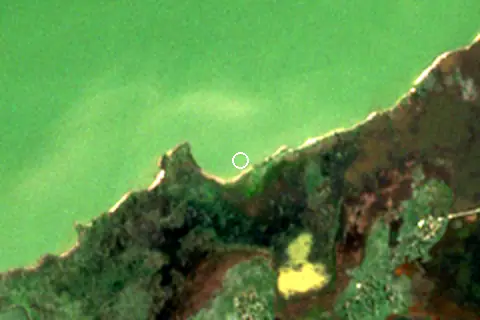
Within 1 km, the land is 99% wetland (satellite land-cover map, 2021): a largely natural setting. Water makes up 50% of that circle.
- Wetland 99%
Land cover: ESA WorldCover 2021 (10 m).
Nearest services
The nearest place to eat or drink is 9.8 km south-east (VMMR Community Club - Golden Beach).
| Service | Nearest mapped | Distance | Direction |
|---|---|---|---|
| Food and drink | VMMR Community Club - Golden Beach | 9.8 km | south-east |
| Accommodation | Seacombe Camping Area | 8.8 km | east |
| Car park | — | 10.2 km | south-east |
| Public toilets | — | 10.3 km | south-east |
| Bus stop | Golden Beach Community Hall/Longford-Golden Beach Rd | 10.2 km | south-east |
Straight-line distance to the nearest feature within 20 km, from OpenStreetMap and Overture Maps places. A category is missing when nothing is mapped within 20 km.
Getting there
| Airport | Code | Distance | Direction |
|---|---|---|---|
| Mount Hotham Airport Mount Hotham | MHU | 121 km | north |
| Melbourne Moorabbin Airport Melbourne | MBW | 197 km | west |
| Melbourne Essendon Airport Essendon Fields | MEB | 218 km | west |
Straight-line distances from the beach; road distance is usually 20–40% longer.
No town of 1,000+ people lies within 10 km; within 30 km there are 4 (about 19.3K).
Map and nearby beaches
Loading map…
Open in OpenStreetMap · Directions in Google Maps
| Beach | Distance | Warmest sea | Length | Surface |
|---|---|---|---|---|
| Wild Dog Shore | – | 19.0 °C | – | – |
| Ninety Mile Beach | 10.2 km S | 19.1 °C | – | – |
| Delray Beach | 12.6 km S | 19.1 °C | – | – |
| The Wreck Beach | 13.6 km S | 19.1 °C | – | – |
| Flamingo Beach | 16.9 km S | 19.1 °C | 3.3 km | Sand |
| Glomar Beach | 18.5 km S | 19.1 °C | 5.1 km | Sand |
| Ninety Mile Beach | 20.9 km E | 19.0 °C | – | – |
- Ninety Mile Beach10.2 km SCompare
- Delray Beach12.6 km SCompare
- The Wreck Beach13.6 km SCompare
- Flamingo Beach16.9 km SCompare
- Glomar Beach18.5 km SCompare
- Ninety Mile Beach20.9 km ECompare
- Cherry Tree Beach31.9 km NECompare
- Mcgauran Beach40.7 km SWCompare
Data on this page
- Air temperature, rain, cloud, wind, humidity: NASA POWER climatology 2001–2020, 0.5° grid.
- Sea temperature: NOAA OISST v2.1 monthly normals 1991–2020, nearest ocean cell 25.0 km away.
- Water body, status and length: Wikidata (CC0).
- Towns and time zone: GeoNames (CC BY 4.0). Airports: OurAirports (public domain). Sunrise and sunset: NOAA solar equations.
- Satellite view: Copernicus Sentinel-2 (ESA), scene S2B_55HET_20241003_0_L2A.
- Settlements: GeoNames places with 1,000+ inhabitants.
- Nearest services: OpenStreetMap and Overture Maps places within 20 km.
- Land cover: ESA WorldCover 2021, 10 m (CC BY 4.0).
Data compiled 2026-10-13. Something wrong? Report a data error.