Canada / British Columbia
Foster Bar
Foster Bar is an inland beach, 21.6 km south-east of Lillooet (British Columbia, Canada). Average daytime highs peak at 23 °C in July and drop to -5 °C in December.
Weather month by month
November at Foster Bar
Beach-day index 3.8/10 · Canada median 2.2
| Measure | Jan | Feb | Mar | Apr | May | Jun | Jul | Aug | Sep | Oct | Nov | Dec |
|---|---|---|---|---|---|---|---|---|---|---|---|---|
| High °C | -4° | -2° | 2° | 8° | 15° | 18° | 23° | 23° | 17° | 8° | 0° | -5° |
| Low °C | -12° | -12° | -7° | -3° | 2° | 6° | 9° | 8° | 4° | -2° | -7° | -12° |
| Rain mm | 41 | 31 | 36 | 32 | 50 | 59 | 42 | 33 | 44 | 44 | 49 | 44 |
| Cloud % | 76 | 70 | 73 | 72 | 70 | 68 | 49 | 50 | 58 | 68 | 76 | 76 |
| Wind m/s | 1.8 | 1.7 | 1.9 | 1.9 | 1.7 | 1.6 | 1.6 | 1.6 | 1.6 | 1.7 | 1.8 | 1.8 |
| Daylight h | 8.5 | 10.0 | 11.8 | 13.7 | 15.4 | 16.4 | 16.1 | 14.6 | 12.7 | 10.8 | 9.0 | 8.0 |
| Record high/low | 5°/-35° | 8°/-30° | 17°/-26° | 23°/-12° | 29°/-6° | 32°/-2° | 34°/1° | 34°/-0° | 30°/-4° | 24°/-15° | 13°/-29° | 5°/-36° |
| Beach index | 3.9 | 4.1 | 4.0 | 4.0 | 3.9 | 4.6 | 7.8 | 7.5 | 4.1 | 3.9 | 3.8 | 3.8 |
Long-term monthly averages: air from NASA POWER (2001–2020), sea from NOAA OISST (1991–2020); records are the extremes of 2001–2020. How the index works.
Setting
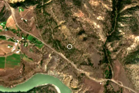
Within 1 km, the land is 63% tree cover, 27% grassland and 8% bare ground, sand or rock (satellite land-cover map, 2021): a largely natural setting. Water makes up 6% of that circle.
- Tree 63%
- Grass 27%
- Bare 8%
Land cover: ESA WorldCover 2021 (10 m).
This is not a sea beach, so no sea-temperature normals are shown.
When to go
The beach-day index peaks in July–August; July scores 7.8/10 with highs of 23 °C and 42 mm of rain.
In July that is 3.0 points above the median of the 1,211 beaches in Canada covered by this atlas.
June is the wettest month (59 mm) and February the driest (31 mm); the yearly total is about 510 mm.
Daylight runs from 8.0 hours in December to 16.4 hours in June; in mid-July the sun rises at 05:10 and sets at 21:14 local time.
Nearest services
The nearest place to eat or drink is 3.0 km north-west (Texas Bar).
| Service | Nearest mapped | Distance | Direction |
|---|---|---|---|
| Food and drink | Texas Bar | 3.0 km | north-west |
| Accommodation | Willows Campground | 16.0 km | north-west |
| Car park | — | 4.6 km | north-west |
Straight-line distance to the nearest feature within 20 km, from OpenStreetMap and Overture Maps places. A category is missing when nothing is mapped within 20 km.
Getting there
| Airport | Code | Distance | Direction |
|---|---|---|---|
| Kamloops John Moose Fulton Field Regional Airport Kamloops | YKA | 93.9 km | east |
| Abbotsford International Airport Abbotsford | YXX | 173 km | south |
| Kelowna International Airport Kelowna | YLW | 181 km | east |
Straight-line distances from the beach; road distance is usually 20–40% longer.
No town of 1,000+ people lies within 10 km; within 30 km there are 1 (about 2.3K).
Reference
Foster Bar, originally known as Foster's Bar, is a gold-bearing sandbar in the Fraser Canyon of British Columbia, Canada as well as the name used for the surrounding locality, which includes Nesikep Indian Reserve 6 and Nesikep Indian Reserve 6A of the Cayoose Creek First Nation of the St'at'imc people and Lytton Indian Reserves Nos. 6A and 5B and Seah Indian Reserve No.
Wikidata item Q5473627 · classified as human settlement.
When people look it up
The EN Wikipedia article was read 289 times in the 12 months to August 2026. Interest peaks in March (48 views), 3.0× the quietest month.
Map and nearby beaches
Loading map…
Open in OpenStreetMap · Directions in Google Maps
| Beach | Distance | Warmest sea | Length | Surface |
|---|---|---|---|---|
| Foster Bar | – | – | – | – |
| Texas Bar | 3.0 km NW | – | – | – |
| Cantilever Bar | 44.2 km S | – | – | – |
- Texas Bar3.0 km NWCompare
- Cantilever Bar44.2 km SCompare
Data on this page
- Air temperature, rain, cloud, wind, humidity: NASA POWER climatology 2001–2020, 0.5° grid.
- Water body, status and length: Wikidata (CC0).
- Towns and time zone: GeoNames (CC BY 4.0). Airports: OurAirports (public domain). Sunrise and sunset: NOAA solar equations.
- Satellite view: Copernicus Sentinel-2 (ESA), scene S2A_10UEA_20230902_0_L2A.
- Settlements: GeoNames places with 1,000+ inhabitants.
- Nearest services: OpenStreetMap and Overture Maps places within 20 km.
- Land cover: ESA WorldCover 2021, 10 m (CC BY 4.0).
Data compiled 2026-10-13. Something wrong? Report a data error.