Chile / Valparaiso
Santo Domingo
Santo Domingo is a coastal resort area in Valparaiso, Chile. The sea averages 16.2 °C in February, its warmest month, and 12.2 °C in August; it never reaches 21 °C on average.
Average sea surface temperature by month. Current month outlined.
The sea peaks at 16.2 °C in February. Most swimmers find water below 20 °C cold; a wetsuit is common here.
Services in the resort
- –Restaurants, cafés & bars
- –Public toilets
- –Showers
- –Car parks
- –Lifeguard stations
- 1Bus stops (1.5 km)
Counted within 1 km of the beach (bus stops 1.5 km) from OpenStreetMap features and Overture Maps places, release of 2026-10. Unmapped does not mean absent.
Nearest services
The nearest place to eat or drink is 10.6 km south (La Guarida del Tigre), the nearest grocery shop is 3.5 km west (Minimarket Don Pancho) and the nearest pharmacy or clinic is 8.5 km south (Posta Rural Bucalemu).
| Service | Nearest mapped | Distance | Direction |
|---|---|---|---|
| Food and drink | La Guarida del Tigre | 10.6 km | south |
| Groceries | Minimarket Don Pancho | 3.5 km | west |
| Accommodation | Condominio Las Brisas De Santo Domingo | 10.1 km | north-east |
| Pharmacy or clinic | Posta Rural Bucalemu | 8.5 km | south |
| Car park | Estacionamiento Giverni | 7.0 km | north-east |
| Public toilets | — | 7.2 km | north-east |
| Bus stop | — | 1.1 km | north |
Straight-line distance to the nearest feature within 20 km, from OpenStreetMap and Overture Maps places. A category is missing when nothing is mapped within 20 km.
Month by month
November at Santo Domingo
Beach-day index 6.8/10 · Chile median 5.9
| Measure | Jan | Feb | Mar | Apr | May | Jun | Jul | Aug | Sep | Oct | Nov | Dec |
|---|---|---|---|---|---|---|---|---|---|---|---|---|
| Sea °C | 15.9 °C | 16.2 °C | 15.7 °C | 14.3 °C | 13.5 °C | 13.1 °C | 12.5 °C | 12.2 °C | 12.4 °C | 12.7 °C | 13.4 °C | 14.7 °C |
| High °C | 29° | 28° | 26° | 22° | 18° | 15° | 14° | 15° | 17° | 21° | 25° | 27° |
| Low °C | 13° | 12° | 11° | 9° | 8° | 6° | 5° | 5° | 6° | 7° | 9° | 11° |
| Rain mm | 1 | 3 | 5 | 12 | 59 | 75 | 63 | 56 | 16 | 11 | 6 | 3 |
| Cloud % | 40 | 42 | 44 | 48 | 62 | 60 | 58 | 56 | 54 | 53 | 43 | 41 |
| Wind m/s | 3.3 | 3.1 | 2.9 | 2.6 | 2.3 | 2.4 | 2.4 | 2.5 | 2.6 | 2.9 | 3.3 | 3.4 |
| Daylight h | 14.2 | 13.3 | 12.4 | 11.3 | 10.4 | 9.9 | 10.1 | 10.8 | 11.8 | 12.9 | 13.9 | 14.4 |
| Record high/low | 38°/8° | 36°/8° | 37°/7° | 33°/3° | 32°/3° | 28°/-1° | 27°/-2° | 29°/-0° | 30°/0° | 33°/3° | 35°/4° | 36°/6° |
| Beach index | 7.4 | 7.4 | 7.2 | 5.7 | 3.5 | 2.8 | 2.9 | 3.0 | 3.5 | 4.9 | 6.8 | 7.1 |
Long-term monthly averages: air from NASA POWER (2001–2020), sea from NOAA OISST (1991–2020); records are the extremes of 2001–2020. How the index works.
When to go
The beach-day index peaks in December–March; January scores 7.4/10 with highs of 29 °C, sea at 15.9 °C and 1 mm of rain.
In January that is 0.4 points above the median of the 204 beaches in Chile covered by this atlas.
Across the year the sea averages 13.9 °C, cooler than 77% of the coastal beaches in the atlas.
June is the wettest month (75 mm) and January the driest (1 mm); the yearly total is about 310 mm.
Daylight runs from 9.9 hours in June to 14.4 hours in December; in mid-January the sun rises at 06:50 and sets at 21:00 local time.
Setting
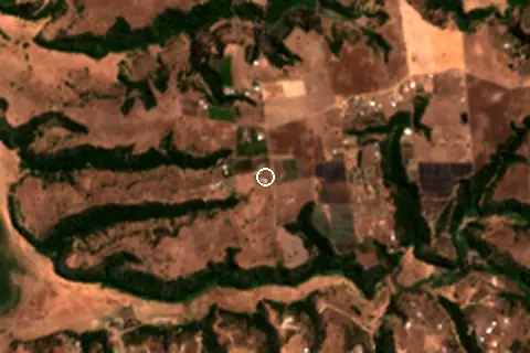
Within 1 km, the land is 42% tree cover, 30% cropland and 27% grassland (satellite land-cover map, 2021): a rural setting among farmland.
- Tree 42%
- Crop 30%
- Grass 27%
Land cover: ESA WorldCover 2021 (10 m).
Getting there
| Airport | Code | Distance | Direction |
|---|---|---|---|
| Comodoro Arturo Merino Benítez International Airport Santiago | SCL | 93.3 km | north-east |
| Governor Francisco Gabrielli International Airport Mendoza | MDZ | 288 km | east |
| Suboficial Ay Santiago Germano Airport San Rafael | AFA | 314 km | east |
Straight-line distances from the beach; road distance is usually 20–40% longer.
Local transport: 1 bus stop within 1.5 km.
No town of 1,000+ people lies within 10 km; within 30 km there are 3 (about 112.3K).
Map and nearby beaches
Loading map…
Open in OpenStreetMap · Directions in Google Maps
| Beach | Distance | Warmest sea | Length | Surface |
|---|---|---|---|---|
| Santo Domingo | – | 16.2 °C | – | – |
| Salinas El Convento | 3.7 km SW | 16.5 °C | – | – |
| Playa de Santo Domingo | 13.9 km N | 16.2 °C | 570 m | Sand |
| Playa Sur | 17.5 km N | 16.2 °C | – | – |
| Playa de Llolleo | 20.4 km N | 16.2 °C | 1.2 km | Sand |
| Playa Matanzas | 27.0 km SW | 16.5 °C | 244 m | – |
| Playa Chica | 27.1 km N | 16.2 °C | 418 m | Sand |
- Salinas El Convento3.7 km SWCompare
- Playa de Santo Domingo13.9 km NCompare
- Playa Sur17.5 km NCompare
- Playa de Llolleo20.4 km NCompare
- Playa Matanzas27.0 km SWCompare
- Playa Chica27.1 km NCompare
- Playa San Sebastián28.4 km NCompare
Data on this page
- Air temperature, rain, cloud, wind, humidity: NASA POWER climatology 2001–2020, 0.5° grid.
- Sea temperature: NOAA OISST v2.1 monthly normals 1991–2020, nearest ocean cell 18.5 km away.
- Beach outline, surface, rules and public facilities: OpenStreetMap contributors (ODbL); restaurants, cafés, bars and lodging: Overture Maps places (CDLA-Permissive-2.0).
- Towns and time zone: GeoNames (CC BY 4.0). Airports: OurAirports (public domain). Sunrise and sunset: NOAA solar equations.
- Satellite view: Copernicus Sentinel-2 (ESA), scene S2B_18HYH_20240308_0_L2A.
- Settlements: GeoNames places with 1,000+ inhabitants.
- Nearest services: OpenStreetMap and Overture Maps places within 20 km.
- Land cover: ESA WorldCover 2021, 10 m (CC BY 4.0).
- Search popularity: about 590 Google searches a month for the name (KeywordTool, October 2026).
Data compiled 2026-10-13. Something wrong? Report a data error.