Croatia / Šibenik-Knin
Plaža Ljubač
Plaža Ljubač is a beach, 2.1 km west of Knin (Šibenik-Knin, Croatia). The sea averages 24.2 °C in August, its warmest month, and 13.0 °C in February; it is 21 °C or warmer in June–September.
Average sea surface temperature by month. Current month outlined.
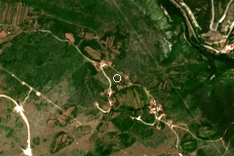
Setting
Within 1 km, the land is 61% tree cover, 25% shrubland and 13% grassland (satellite land-cover map, 2021): a largely natural setting.
- Tree 61%
- Shrub 25%
- Grass 13%
Land cover: ESA WorldCover 2021 (10 m).
Facilities within 1 km
- –Restaurants, cafés & bars
- –Public toilets
- –Showers
- –Car parks
- –Lifeguard stations
Counted within 1 km of the beach (bus stops 1.5 km) from OpenStreetMap features and Overture Maps places, release of 2026-10. Unmapped does not mean absent.
Nearest services
The nearest place to eat or drink is 1.3 km east (Caffe bar Royal Terrace ), the nearest grocery shop is 2.0 km east (Studenac Market), the nearest fuel station is 1.8 km south-east (P.S. Knin) and the nearest pharmacy or clinic is 2.1 km east (dm).
| Service | Nearest mapped | Distance | Direction |
|---|---|---|---|
| Food and drink | Caffe bar Royal Terrace | 1.3 km | east |
| Groceries | Studenac Market | 2.0 km | east |
| Accommodation | Apartman Kastel - KNIN | 2.0 km | east |
| Pharmacy or clinic | dm | 2.1 km | east |
| Fuel station | P.S. Knin | 1.8 km | south-east |
| Car park | — | 1.8 km | east |
| Public toilets | — | 1.7 km | east |
| Bus stop | — | 1.9 km | north-east |
Straight-line distance to the nearest feature within 20 km, from OpenStreetMap and Overture Maps places. A category is missing when nothing is mapped within 20 km.
Around the beach
Nature
- Spas peak 1.5 km E
Getting there
| Airport | Code | Distance | Direction |
|---|---|---|---|
| Split Saint Jerome Airport Split | SPU | 56.2 km | south |
| Zadar Airport Zadar | ZAD | 65.7 km | west |
| Brač Airport Gornji Humac | BWK | 93.0 km | south-east |
Straight-line distances from the beach; road distance is usually 20–40% longer.
Local transport: rail station Knin (2.2 km).
2 towns and villages of 1,000+ people lie within 10 km (about 8.5K residents); within 30 km there are 11 (about 20.5K).
Map and nearby beaches
Loading map…
Open in OpenStreetMap · Directions in Google Maps
| Beach | Distance | Warmest sea | Length | Surface |
|---|---|---|---|---|
| Plaža Ljubač | – | 24.2 °C | – | – |
| Beach Banj, Šibenik | 40.1 km SW | 24.4 °C | 157 m | Pebble |
| Plaža Jadrija | 43.4 km SW | 24.4 °C | – | – |
| Zablaće | 43.9 km SW | 24.4 °C | 368 m | Fine gravel |
| Vodice | 44.2 km SW | 24.4 °C | 641 m | Pebble |
| Brodarica | 44.5 km SW | 24.4 °C | 511 m | Gravel |
| Plava plaža | 45.2 km SW | 24.4 °C | 641 m | Pebble |
- Beach Banj, Šibenik40.1 km SWCompare
- Plaža Jadrija43.4 km SWCompare
- Zablaće43.9 km SWCompare
- Vodice44.2 km SWCompare
- Brodarica44.5 km SWCompare
- Plava plaža45.2 km SWCompare
- Žaborić45.3 km SWCompare
- Grebaštica47.6 km SCompare
Data on this page
- Sea temperature: NOAA OISST v2.1 monthly normals 1991–2020, nearest ocean cell 47.3 km away.
- Beach outline, surface, rules and public facilities: OpenStreetMap contributors (ODbL); restaurants, cafés, bars and lodging: Overture Maps places (CDLA-Permissive-2.0).
- Towns and time zone: GeoNames (CC BY 4.0). Airports: OurAirports (public domain). Sunrise and sunset: NOAA solar equations.
- Satellite view: Copernicus Sentinel-2 (ESA), scene S2C_33TWJ_20260730_0_L2A.
- Settlements: GeoNames places with 1,000+ inhabitants.
- Nearest services: OpenStreetMap and Overture Maps places within 20 km.
- Land cover: ESA WorldCover 2021, 10 m (CC BY 4.0).
- Search popularity: about 1K Google searches a month for the name (KeywordTool, October 2026).
Data compiled 2026-10-13. Something wrong? Report a data error.