Greece / Crete
Richtis Gorge
Richtis Gorge is a beach, 11.6 km south-west of Sitia (Crete, Greece). The sea averages 25.1 °C in August, its warmest month, and 15.7 °C in February; it is 21 °C or warmer in June–October.
Average sea surface temperature by month. Current month outlined.

Reference
Richtis Gorge (Greek: Φαράγγι του Ρίχτη, Faraggi tou Richti) is a gorge in Crete, Greece (Map of Richtis Gorge here). It is a state protected park near Exo Mouliana, Sitia, eastern Crete (Greece) that starts at the traditional village Exo Mouliana, which is located on the national road between Agios Nikolaos and Sitia and ends at the secluded Richtis beach, just east of the village Kalavros.
Wikidata item Q7331108 · classified as waterfall.
Month by month
November at Richtis Gorge
Beach-day index 5.4/10 · Greece median 4.3
| Measure | Jan | Feb | Mar | Apr | May | Jun | Jul | Aug | Sep | Oct | Nov | Dec |
|---|---|---|---|---|---|---|---|---|---|---|---|---|
| Sea °C | 16.1 °C | 15.7 °C | 15.9 °C | 16.8 °C | 19.1 °C | 22.3 °C | 24.4 °C | 25.1 °C | 24.5 °C | 22.7 °C | 20.2 °C | 17.8 °C |
| High °C | 15° | 15° | 16° | 17° | 20° | 24° | 26° | 26° | 25° | 23° | 20° | 17° |
| Low °C | 14° | 14° | 15° | 16° | 19° | 22° | 24° | 25° | 24° | 21° | 19° | 16° |
| Rain mm | 108 | 88 | 50 | 27 | 18 | 7 | 2 | 3 | 18 | 51 | 64 | 103 |
| Cloud % | 72 | 70 | 61 | 53 | 40 | 22 | 14 | 15 | 29 | 50 | 64 | 74 |
| Wind m/s | 7.2 | 7.0 | 6.3 | 5.8 | 5.0 | 5.7 | 7.0 | 6.8 | 6.2 | 5.7 | 5.9 | 6.9 |
| Daylight h | 10.0 | 10.9 | 11.9 | 13.0 | 14.0 | 14.5 | 14.3 | 13.5 | 12.5 | 11.4 | 10.4 | 9.8 |
| Record high/low | 19°/7° | 19°/6° | 21°/7° | 22°/11° | 26°/15° | 30°/19° | 29°/22° | 31°/23° | 29°/20° | 27°/16° | 25°/11° | 22°/8° |
| Beach index | 2.2 | 2.3 | 2.9 | 3.7 | 5.9 | 8.6 | 9.3 | 9.4 | 9.2 | 7.6 | 5.4 | 2.8 |
Long-term monthly averages: air from NASA POWER (2001–2020), sea from NOAA OISST (1991–2020); records are the extremes of 2001–2020. How the index works.
When to go
The beach-day index peaks in July–September; August scores 9.4/10 with highs of 26 °C, sea at 25.1 °C and 3 mm of rain.
That matches the median for beaches in Greece in the same month.
At its warmest the water here is 0.5 °C cooler than the Greece median for August (25.6 °C).
Across the year the sea averages 20.1 °C, warmer than 62% of the coastal beaches in the atlas.
January is the wettest month (108 mm) and July the driest (2 mm); the yearly total is about 540 mm.
Daylight runs from 9.8 hours in December to 14.5 hours in June; in mid-August the sun rises at 06:35 and sets at 20:06 local time.
Setting
Within 1 km, the land is 71% tree cover, 17% grassland and 9% shrubland (satellite land-cover map, 2021): a largely natural setting.
- Tree 71%
- Grass 17%
- Shrub 9%
Land cover: ESA WorldCover 2021 (10 m).
Average wind speed at 10 m reaches 7.2 m/s in January, the windiest month.
Photos


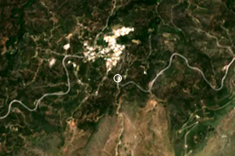
From above
Facilities within 1 km
- –Restaurants, cafés & bars
- –Public toilets
- –Showers
- 1Car parks
- –Lifeguard stations
- 2Bus stops (1.5 km)
Counted within 1 km of the beach (bus stops 1.5 km) from OpenStreetMap features and Overture Maps places, release of 2026-10. Unmapped does not mean absent.
Nearest services
The nearest place to eat or drink is 1.7 km west (Agrilos), the nearest grocery shop is 9.8 km north-east (Lidl), the nearest fuel station is 1.7 km west (ΚΑΛΥΒΑΣ ΝΙΚΟΛΑΟΣ ΚΑΙ ΕΜΜΑΝΟΥΗΛ ΟΕ) and the nearest pharmacy or clinic is 4.5 km west (Φαρμακείο Ασπραδάκη).
| Service | Nearest mapped | Distance | Direction |
|---|---|---|---|
| Food and drink | Agrilos | 1.7 km | west |
| Groceries | Lidl | 9.8 km | north-east |
| Accommodation | Cressa Ghitonia Village, Hotel, Sfaka | 6.1 km | west |
| Pharmacy or clinic | Φαρμακείο Ασπραδάκη | 4.5 km | west |
| Fuel station | ΚΑΛΥΒΑΣ ΝΙΚΟΛΑΟΣ ΚΑΙ ΕΜΜΑΝΟΥΗΛ ΟΕ | 1.7 km | west |
| Car park | Парковка ущелья Рихтис | 0 m | south-east |
| Public toilets | — | 3.2 km | west |
| Bus stop | ΕΞΩ ΜΟΥΛΙΑΝΑ | 300 m | north |
Straight-line distance to the nearest feature within 20 km, from OpenStreetMap and Overture Maps places. A category is missing when nothing is mapped within 20 km.
Getting there
| Airport | Code | Distance | Direction |
|---|---|---|---|
| Sitia Airport Crete Island | JSH | 11.7 km | north-east |
| Heraklion International Nikos Kazantzakis Airport Heraklion | HER | 76.0 km | west |
| Karpathos Airport Karpathos Island | AOK | 109 km | east |
Straight-line distances from the beach; road distance is usually 20–40% longer.
Local transport: 2 bus stops within 1.5 km and 1 mapped car park within 1 km.
No town of 1,000+ people lies within 10 km; within 30 km there are 9 (about 42.5K).
When people look it up
The EN Wikipedia article was read 2,995 times in the 12 months to August 2026. Interest peaks in September (417 views), 3.4× the quietest month.
Map and nearby beaches
Loading map…
Open in OpenStreetMap · Directions in Google Maps
| Beach | Distance | Warmest sea | Length | Surface |
|---|---|---|---|---|
| Richtis Gorge | – | 25.1 °C | – | – |
| Maronia | 8.8 km E | 25.0 °C | – | – |
| Παραλία Θόλος | 11.6 km W | 25.1 °C | 317 m | – |
| Chani beach | 13.9 km S | 26.0 °C | 812 m | – |
| Limanaki Beach | 14.1 km S | 26.0 °C | 165 m | Sand |
| Lagoufa beach | 14.2 km S | 26.0 °C | 211 m | – |
| Kalamokanias beach | 14.4 km S | 26.0 °C | 356 m | Pebble |
- Maronia8.8 km ECompare
- Παραλία Θόλος11.6 km WCompare
- Chani beach13.9 km SCompare
- Limanaki Beach14.1 km SCompare
- Lagoufa beach14.2 km SCompare
- Kalamokanias beach14.4 km SCompare
- Diaskari Beach15.0 km SCompare
- Langada Beach15.1 km SCompare
Data on this page
- Air temperature, rain, cloud, wind, humidity: NASA POWER climatology 2001–2020, 0.5° grid.
- Sea temperature: NOAA OISST v2.1 monthly normals 1991–2020, nearest ocean cell 25.6 km away.
- Beach outline, surface, rules and public facilities: OpenStreetMap contributors (ODbL); restaurants, cafés, bars and lodging: Overture Maps places (CDLA-Permissive-2.0).
- Water body, status and length: Wikidata (CC0).
- Towns and time zone: GeoNames (CC BY 4.0). Airports: OurAirports (public domain). Sunrise and sunset: NOAA solar equations.
- Photos: Wikimedia Commons, author and licence under each image.
- Satellite view: Copernicus Sentinel-2 (ESA), scene S2B_35SLU_20260531_0_L2A.
- Settlements: GeoNames places with 1,000+ inhabitants.
- Nearest services: OpenStreetMap and Overture Maps places within 20 km.
- Land cover: ESA WorldCover 2021, 10 m (CC BY 4.0).
Data compiled 2026-10-13. Something wrong? Report a data error.