Poland / Podlasie
Plaża Kownatki
Plaża Kownatki is an inland beach, 7.4 km north of Radziłów (Podlasie, Poland).
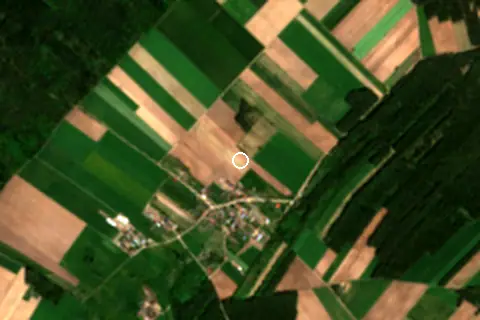
Setting
Within 1 km, the land is 53% cropland, 31% tree cover and 14% grassland (satellite land-cover map, 2021): a rural setting among farmland.
- Crop 53%
- Tree 31%
- Grass 14%
Land cover: ESA WorldCover 2021 (10 m).
This is not a sea beach, so no sea-temperature normals are shown.
Nearest services
The nearest place to eat or drink is 7.1 km south (Fufinka torty Pałac Biebrzański), the nearest grocery shop is 7.2 km south (Top Market), the nearest fuel station is 14.1 km north-west (Stacja Paliw ORLEN) and the nearest pharmacy or clinic is 7.4 km south (DOZ Punkt Apteczny dbam o zdrowie).
| Service | Nearest mapped | Distance | Direction |
|---|---|---|---|
| Food and drink | Fufinka torty Pałac Biebrzański | 7.1 km | south |
| Groceries | Top Market | 7.2 km | south |
| Accommodation | Into The Las | 6.2 km | east |
| Pharmacy or clinic | DOZ Punkt Apteczny dbam o zdrowie | 7.4 km | south |
| Fuel station | Stacja Paliw ORLEN | 14.1 km | north-west |
| Car park | — | 6.1 km | south-east |
| Public toilets | — | 8.1 km | south-east |
| Bus stop | — | 7.3 km | south |
Straight-line distance to the nearest feature within 20 km, from OpenStreetMap and Overture Maps places. A category is missing when nothing is mapped within 20 km.
Getting there
| Airport | Code | Distance | Direction |
|---|---|---|---|
| Olsztyn-Mazury Airport Szymany | SZY | 99.2 km | west |
| Warsaw Modlin Airport Nowy Dwór Mazowiecki | WMI | 165 km | south-west |
| Warsaw Chopin Airport Warsaw | WAW | 176 km | south-west |
Straight-line distances from the beach; road distance is usually 20–40% longer.
2 towns and villages of 1,000+ people lie within 10 km (about 3K residents); within 30 km there are 10 (about 53.1K).
Map and nearby beaches
Loading map…
Data on this page
- Towns and time zone: GeoNames (CC BY 4.0). Airports: OurAirports (public domain). Sunrise and sunset: NOAA solar equations.
- Satellite view: Copernicus Sentinel-2 (ESA), scene S2A_34UEE_20240501_0_L2A.
- Settlements: GeoNames places with 1,000+ inhabitants.
- Nearest services: OpenStreetMap and Overture Maps places within 20 km.
- Land cover: ESA WorldCover 2021, 10 m (CC BY 4.0).
- Search popularity: about 2.9K Google searches a month for the name (KeywordTool, October 2026).
Data compiled 2026-10-13. Something wrong? Report a data error.