Portugal / Santarém
Praia Fluvial Olhos d'Água
Praia Fluvial Olhos d'Água is an 86 m-long inland beach, 1.9 km south of Monsanto (Santarém, Portugal). Average daytime highs peak at 33 °C in August and drop to 13 °C in January.

Weather month by month
November at Praia Fluvial Olhos d'Água
Beach-day index 3.5/10 · Portugal median 3.7
| Measure | Jan | Feb | Mar | Apr | May | Jun | Jul | Aug | Sep | Oct | Nov | Dec |
|---|---|---|---|---|---|---|---|---|---|---|---|---|
| High °C | 13° | 14° | 17° | 20° | 24° | 29° | 32° | 33° | 29° | 23° | 17° | 13° |
| Low °C | 3° | 4° | 6° | 8° | 11° | 14° | 15° | 16° | 15° | 11° | 6° | 4° |
| Rain mm | 82 | 65 | 77 | 67 | 46 | 20 | 7 | 10 | 34 | 101 | 101 | 78 |
| Cloud % | 62 | 56 | 58 | 57 | 49 | 42 | 31 | 30 | 38 | 53 | 57 | 60 |
| Wind m/s | 3.8 | 3.9 | 4.1 | 3.9 | 3.8 | 4.0 | 4.2 | 4.1 | 3.6 | 3.8 | 3.8 | 3.9 |
| Daylight h | 9.7 | 10.7 | 11.9 | 13.2 | 14.3 | 14.9 | 14.7 | 13.8 | 12.5 | 11.2 | 10.1 | 9.4 |
| Record high/low | 21°/-4° | 23°/-4° | 28°/-4° | 30°/1° | 36°/4° | 40°/8° | 41°/10° | 43°/10° | 42°/9° | 36°/4° | 26°/-1° | 20°/-5° |
| Beach index | 3.6 | 3.9 | 3.9 | 5.7 | 8.5 | 9.2 | 9.0 | 8.6 | 9.1 | 7.1 | 3.5 | 3.7 |
Long-term monthly averages: air from NASA POWER (2001–2020), sea from NOAA OISST (1991–2020); records are the extremes of 2001–2020. How the index works.
Setting
Within 1 km, the land is 60% tree cover, 26% grassland and 7% shrubland (satellite land-cover map, 2021): a largely natural setting.
- Tree 60%
- Grass 26%
- Shrub 7%
- Crop 5%
Land cover: ESA WorldCover 2021 (10 m).
This is not a sea beach, so no sea-temperature normals are shown.
Bathing water quality
The official EU bathing-water site “Olhos De Água Do Alviela” was rated Not classified for the 2025 season.
- 2025Not classified
Source: European Environment Agency, EU Bathing Water Directive assessments · national site profile. Classes are based on four seasons of bacteriological sampling.
When to go
The beach-day index peaks in June–September; June scores 9.2/10 with highs of 29 °C and 20 mm of rain.
In June that is 1.5 points above the median of the 344 beaches in Portugal covered by this atlas.
October is the wettest month (101 mm) and July the driest (7 mm); the yearly total is about 690 mm.
Daylight runs from 9.4 hours in December to 14.9 hours in June; in mid-June the sun rises at 06:06 and sets at 21:02 local time.
Facilities within 1 km
- 1Restaurants, cafés & bars
- 1Public toilets
- –Showers
- 3Car parks
- –Lifeguard stations
- 2Viewpoints
Food and drink mapped within 1 km: 1 restaurant.
Counted within 1 km of the beach (bus stops 1.5 km) from OpenStreetMap features and Overture Maps places, release of 2026-10. Unmapped does not mean absent.
Photos


From above
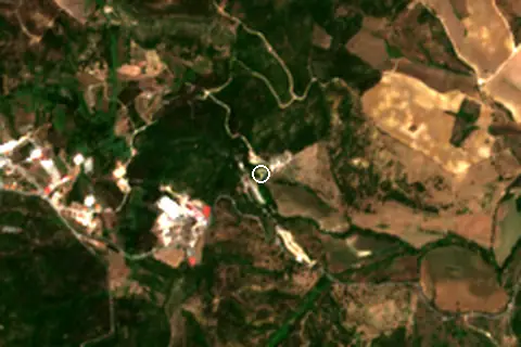
Around the beach
Viewpoints
- Miradouro da Nascente do Alviela 150 m W
- Miradouro do Canhão da Ribeira dos Amiais 190 m W
Attractions & museums
- Centro Ciência Viva do Alviela - Carsoscópio museum 90 m NE
Nature
- Alviela nature reserve 130 m NW
- Gruta do Alviela cave entrance 140 m NW
- Algar de abatimento "Janela Cársica" cave entrance 330 m NW
Getting there
| Airport | Code | Distance | Direction |
|---|---|---|---|
| Lisbon Humberto Delgado Airport Lisbon | LIS | 82.4 km | south-west |
| Cascais Airport Cascais | CAT | 97.5 km | south-west |
| Aerodromo Goncalves Lobato (Viseu Airport) Viseu | VSE | 159 km | north-east |
Straight-line distances from the beach; road distance is usually 20–40% longer.
Local transport: 3 mapped car parks within 1 km.
5 towns and villages of 1,000+ people lie within 10 km (about 60.1K residents); within 30 km there are 40 (about 290.1K).
Map and nearby beaches
Loading map…
Open in OpenStreetMap · Directions in Google Maps
| Beach | Distance | Warmest sea | Length | Surface |
|---|---|---|---|---|
| Praia Fluvial Olhos d'Água | – | – | 86 m | – |
| Praia Fluvial do Agroal | 35.2 km NE | – | 140 m | Pebble |
| Nazaré | 35.5 km NW | 18.7 °C | 1.5 km | Sand |
| Praia Nova | 36.3 km NW | 18.7 °C | – | – |
| São Martinho do Porto | 37.7 km W | 18.7 °C | 1.9 km | Sand |
| Praia das Paredes | 39.3 km NW | 18.7 °C | 1.2 km | Sand |
| Praia de Paredes da Vitória | 41.8 km NW | 18.7 °C | 1.9 km | Sand |
- Praia Fluvial do Agroal35.2 km NECompare
- Nazaré35.5 km NWCompare
- Praia Nova36.3 km NWCompare
- São Martinho do Porto37.7 km WCompare
- Praia das Paredes39.3 km NWCompare
- Praia de Paredes da Vitória41.8 km NWCompare
- Praia Velha45.6 km NWCompare
- Praia Fluvial da Casa Branca47.1 km SCompare
Data on this page
- Air temperature, rain, cloud, wind, humidity: NASA POWER climatology 2001–2020, 0.5° grid.
- Beach outline, surface, rules and public facilities: OpenStreetMap contributors (ODbL), feature w952473849; restaurants, cafés, bars and lodging: Overture Maps places (CDLA-Permissive-2.0).
- Towns and time zone: GeoNames (CC BY 4.0). Airports: OurAirports (public domain). Sunrise and sunset: NOAA solar equations.
- Photos: Wikimedia Commons, author and licence under each image.
- Satellite view: Copernicus Sentinel-2 (ESA), scene S2A_29SND_20260629_0_L2A.
- Bathing-water quality: European Environment Agency (site PTCH9D).
- Settlements: GeoNames places with 1,000+ inhabitants.
- Land cover: ESA WorldCover 2021, 10 m (CC BY 4.0).
- Search popularity: about 320 Google searches a month for the name (KeywordTool, October 2026).
Data compiled 2026-10-13. Something wrong? Report a data error.