Russia / Moscow
Chayka swimming pool
Chayka swimming pool is an inland beach, 2.2 km south-west of Moscow (Moscow, Russia). Average daytime highs peak at 24 °C in July and drop to -8 °C in January. Recorded status on Wikidata: candidate heritage site in Russia.

Weather month by month
November at Chayka swimming pool
Beach-day index 3.4/10 · Russia median 2.7
| Measure | Jan | Feb | Mar | Apr | May | Jun | Jul | Aug | Sep | Oct | Nov | Dec |
|---|---|---|---|---|---|---|---|---|---|---|---|---|
| High °C | -8° | -6° | -0° | 9° | 18° | 21° | 24° | 22° | 16° | 8° | 0° | -5° |
| Low °C | -14° | -14° | -8° | -1° | 8° | 11° | 15° | 13° | 7° | 1° | -5° | -11° |
| Rain mm | 48 | 42 | 42 | 49 | 81 | 83 | 87 | 71 | 62 | 68 | 56 | 51 |
| Cloud % | 81 | 77 | 71 | 66 | 60 | 64 | 61 | 58 | 67 | 81 | 85 | 86 |
| Wind m/s | 5.1 | 5.0 | 4.8 | 4.3 | 4.1 | 3.9 | 3.4 | 3.7 | 4.1 | 4.6 | 4.8 | 5.1 |
| Daylight h | 7.6 | 9.6 | 11.7 | 14.1 | 16.2 | 17.5 | 17.0 | 15.2 | 12.9 | 10.6 | 8.4 | 7.1 |
| Record high/low | 2°/-40° | 1°/-34° | 16°/-24° | 23°/-13° | 30°/-4° | 32°/0° | 34°/6° | 36°/5° | 28°/-2° | 21°/-15° | 13°/-27° | 6°/-32° |
| Beach index | 3.5 | 3.6 | 3.8 | 3.8 | 4.1 | 5.7 | 7.4 | 6.9 | 3.7 | 3.4 | 3.4 | 3.4 |
Long-term monthly averages: air from NASA POWER (2001–2020), sea from NOAA OISST (1991–2020); records are the extremes of 2001–2020. How the index works.
Setting
Within 1 km, the land is 79% built-up land and 20% tree cover (satellite land-cover map, 2021): an urban beach. Water makes up 9% of that circle.
- Built 79%
- Tree 20%
Land cover: ESA WorldCover 2021 (10 m).
This is not a sea beach, so no sea-temperature normals are shown.
When to go
The beach-day index peaks in July–August; July scores 7.4/10 with highs of 24 °C and 87 mm of rain.
In July that is 1.6 points above the median of the 61 beaches in Russia covered by this atlas.
July is the wettest month (87 mm) and February the driest (42 mm); the yearly total is about 740 mm.
Daylight runs from 7.1 hours in December to 17.5 hours in June; in mid-July the sun rises at 04:04 and sets at 21:06 local time.
Facilities within 1 km
- 255Restaurants, cafés & bars
- 24Public toilets
- –Showers
- 6Drinking water
- 72Car parks
- –Lifeguard stations
- 27Hotels & guesthouses
- 25Grocery shops
- 5Water-sports spots
- 1Marinas & slipways
- 1Playgrounds & water parks
- 100Bus stops (1.5 km)
- 35Pharmacies & clinics
- 19Cash machines
- 2Bike rental
- 10Viewpoints
- 6Historic sites
Food and drink mapped within 1 km: 130 restaurants, 80 cafés, 36 bars and 9 fast-food outlets. Accommodation: 27 hotels and guesthouses.
Counted within 1 km of the beach (bus stops 1.5 km) from OpenStreetMap features and Overture Maps places, release of 2026-10. Unmapped does not mean absent.
Photos


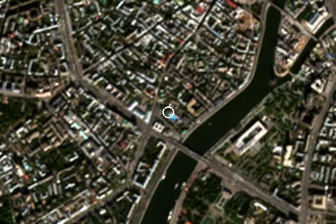
From above
Around the beach
Attractions & museums
- Музей Москвы museum 160 m W
- Детский центр Музея Москвы museum 190 m W
- Мемориальный дом-музей И. С. Тургенева museum 220 m N
- Гослитмузей museum 290 m W
- Арка Марка museum 290 m W
- Музейный центр «Зубовский, 15» museum 300 m W
Historic sites
- Дом Мастера monument 400 m N
- Памятник Сурикову monument 600 m NW
- Памятник Ф.Э. Дзержинскому monument 790 m E
- Памятник Нансену monument 840 m NW
- Памятник Фридриху Энгельсу monument 920 m N
- Памятник Льву Толстому monument 930 m W
Islands in view
- Очарованный остров 1.6 km SW
- Болотный остров 2.1 km E
Marinas
- Пешеходная Крымская Набережная 510 m E
Diving & boat hire
- Велобайк № 100 240 m SW
- Велобайк № 200 310 m S
- Велопрокат "Крути педали" 410 m W
- Electra Музеон 740 m SE
- Velobike 156 820 m SE
Getting there
| Airport | Code | Distance | Direction |
|---|---|---|---|
| Vnukovo International Airport Moscow | VKO | 26.5 km | south-west |
| Sheremetyevo International Airport Moscow | SVO | 29.8 km | north-west |
| Zhukovsky International Airport Moscow | ZIA | 40.3 km | south-east |
Straight-line distances from the beach; road distance is usually 20–40% longer.
Local transport: 100 bus stops within 1.5 km, rail station Москва-Пассажирская-Киевская (2.2 km), ferry terminal Крымский мост (450 m), ferry terminal Причал Флотилии "Рэдисон Ройал" (630 m) and 72 mapped car parks within 1 km.
28 towns and villages of 1,000+ people lie within 10 km (about 12.3M residents); within 30 km there are 170 (about 20.4M).
Reference
Chayka swimming pool has an article on the RU Wikipedia: Чайка (бассейн).
Wikidata item Q42161273 · classified as swimming pool, sea bathing and architectural landmark.
When people look it up
The RU Wikipedia article was read 5,231 times in the 12 months to August 2026. Interest peaks in January (539 views), 1.6× the quietest month.
Map
Loading map…
Data on this page
- Air temperature, rain, cloud, wind, humidity: NASA POWER climatology 2001–2020, 0.5° grid.
- Beach outline, surface, rules and public facilities: OpenStreetMap contributors (ODbL); restaurants, cafés, bars and lodging: Overture Maps places (CDLA-Permissive-2.0).
- Water body, status and length: Wikidata (CC0).
- Towns and time zone: GeoNames (CC BY 4.0). Airports: OurAirports (public domain). Sunrise and sunset: NOAA solar equations.
- Photos: Wikimedia Commons, author and licence under each image.
- Satellite view: Copernicus Sentinel-2 (ESA), scene S2A_37UDB_20230923_0_L2A.
- Settlements: GeoNames places with 1,000+ inhabitants.
- Land cover: ESA WorldCover 2021, 10 m (CC BY 4.0).
Data compiled 2026-10-13. Something wrong? Report a data error.