Russia / Samara Oblast
Samara embankment
Samara embankment is a 4.2 km-long inland beach on the Volga, 4.1 km south-west of Samara (Samara Oblast, Russia). Average daytime highs peak at 28 °C in July and drop to -10 °C in January.

Weather month by month
November at Samara embankment
Beach-day index 3.7/10 · Russia median 2.7
| Measure | Jan | Feb | Mar | Apr | May | Jun | Jul | Aug | Sep | Oct | Nov | Dec |
|---|---|---|---|---|---|---|---|---|---|---|---|---|
| High °C | -10° | -8° | -1° | 10° | 20° | 24° | 28° | 26° | 19° | 9° | -0° | -8° |
| Low °C | -17° | -17° | -9° | -0° | 8° | 13° | 16° | 15° | 8° | 1° | -6° | -15° |
| Rain mm | 43 | 32 | 42 | 43 | 43 | 59 | 55 | 40 | 44 | 51 | 44 | 42 |
| Cloud % | 70 | 67 | 69 | 64 | 56 | 58 | 52 | 55 | 65 | 74 | 75 | 71 |
| Wind m/s | 5.1 | 5.2 | 5.1 | 4.8 | 4.3 | 4.0 | 3.8 | 4.0 | 4.2 | 4.7 | 4.6 | 4.7 |
| Daylight h | 8.1 | 9.8 | 11.8 | 13.9 | 15.8 | 16.9 | 16.5 | 14.9 | 12.8 | 10.7 | 8.7 | 7.6 |
| Record high/low | 1°/-40° | 1°/-35° | 16°/-27° | 24°/-15° | 32°/-2° | 37°/2° | 41°/7° | 41°/5° | 33°/-1° | 22°/-9° | 14°/-26° | 2°/-40° |
| Beach index | 3.7 | 3.8 | 3.7 | 3.8 | 5.8 | 8.0 | 8.7 | 8.9 | 5.2 | 3.6 | 3.7 | 3.8 |
Long-term monthly averages: air from NASA POWER (2001–2020), sea from NOAA OISST (1991–2020); records are the extremes of 2001–2020. How the index works.
Setting
Within 1 km, the land is 88% built-up land, 9% tree cover and 3% bare ground, sand or rock (satellite land-cover map, 2021): an urban beach. Water makes up 46% of that circle.
- Built 88%
- Tree 9%
- Bare 3%
Land cover: ESA WorldCover 2021 (10 m).
This is not a sea beach, so no sea-temperature normals are shown.
When to go
The beach-day index peaks in July–August; August scores 8.9/10 with highs of 26 °C and 40 mm of rain.
In August that is 2.0 points above the median of the 61 beaches in Russia covered by this atlas.
June is the wettest month (59 mm) and February the driest (32 mm); the yearly total is about 540 mm.
Daylight runs from 7.6 hours in December to 16.9 hours in June; in mid-August the sun rises at 05:18 and sets at 20:10 local time.
Facilities within 1 km
- 107Restaurants, cafés & bars
- 3Public toilets
- –Showers
- 1Drinking water
- 12Car parks
- –Lifeguard stations
- 16Hotels & guesthouses
- 11Grocery shops
- 1Marinas & slipways
- 22Bus stops (1.5 km)
- 5Pharmacies & clinics
- 4Cash machines
- 1Viewpoints
- 3Historic sites
Food and drink mapped within 1 km: 43 restaurants, 37 cafés, 25 bars and 2 fast-food outlets. Accommodation: 16 hotels and guesthouses.
Counted within 1 km of the beach (bus stops 1.5 km) from OpenStreetMap features and Overture Maps places, release of 2026-10. Unmapped does not mean absent.
Photos


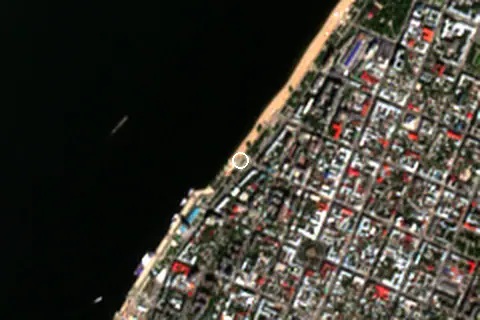
From above
Around the beach
Attractions & museums
- Почта России, ФГУП museum 460 m E
- Самарский областной художественный музей museum 530 m E
- Третьяковка в Самаре museum 710 m E
- Дом-музей М.В. Фрунзе museum 790 m E
- Музей истории г. Самары museum 850 m SE
- Детская картинная галерея museum 850 m NE
Historic sites
- Товарищ Сухов monument 30 m NE
- Фахверковый дом monument 740 m SE
- Дядя Стёпа monument 970 m E
Marinas
- Набережная Самары 260 m NE
Getting there
| Airport | Code | Distance | Direction |
|---|---|---|---|
| Kurumoch International Airport Samara | KUF | 35.5 km | north |
| Ulyanovsk Vostochny Airport Cherdakly | ULY | 159 km | north-west |
| Ulyanovsk Baratayevka Airport Ulyanovsk | ULV | 171 km | north-west |
Straight-line distances from the beach; road distance is usually 20–40% longer.
Local transport: 22 bus stops within 1.5 km, rail station Бухта (1.4 km), ferry terminal 1-ый причал (290 m) and 12 mapped car parks within 1 km.
2 towns and villages of 1,000+ people lie within 10 km (about 1.2M residents); within 30 km there are 11 (about 1.3M).
Reference
The Samara embankment (Russian: Самарская набережная; Samarskaya naberezhnaya) is a 5 km long pedestrianized street along the left bank of the Volga river in Central Samara, Russia. It spans between Lesnaya Street and Samara river port.
Wikidata item Q4406371 · classified as street and river beach.
When people look it up
The EN Wikipedia article was read 587 times in the 12 months to August 2026. Interest peaks in August (69 views), 2.4× the quietest month.
Map
Loading map…
Data on this page
- Air temperature, rain, cloud, wind, humidity: NASA POWER climatology 2001–2020, 0.5° grid.
- Beach outline, surface, rules and public facilities: OpenStreetMap contributors (ODbL); restaurants, cafés, bars and lodging: Overture Maps places (CDLA-Permissive-2.0).
- Water body, status and length: Wikidata (CC0).
- Towns and time zone: GeoNames (CC BY 4.0). Airports: OurAirports (public domain). Sunrise and sunset: NOAA solar equations.
- Photos: Wikimedia Commons, author and licence under each image.
- Satellite view: Copernicus Sentinel-2 (ESA), scene S2B_39UVU_20240828_0_L2A.
- Settlements: GeoNames places with 1,000+ inhabitants.
- Land cover: ESA WorldCover 2021, 10 m (CC BY 4.0).
Data compiled 2026-10-13. Something wrong? Report a data error.