
Setting
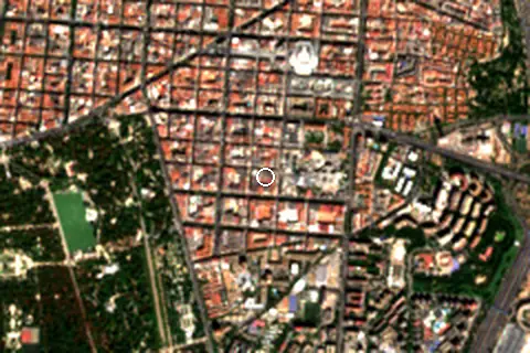
Within 1 km, the land is 75% built-up land and 24% tree cover (satellite land-cover map, 2021): an urban beach. Water makes up 1% of that circle.
- Built 75%
- Tree 24%
Land cover: ESA WorldCover 2021 (10 m).
This is not a sea beach, so no sea-temperature normals are shown.
Facilities within 1 km
- 604Restaurants, cafés & bars
- 10Public toilets
- –Showers
- 44Drinking water
- 51Car parks
- –Lifeguard stations
- 17Hotels & guesthouses
- 1Campsites
- 91Grocery shops
- 3Water-sports spots
- 1Playgrounds & water parks
- 228Bus stops (1.5 km)
- 51Pharmacies & clinics
- 12Cash machines
- 25Bike rental
- 3Viewpoints
- 8Historic sites
Food and drink mapped within 1 km: 462 restaurants, 63 cafés, 72 bars and 7 fast-food outlets. Accommodation: 17 hotels and guesthouses.
Counted within 1 km of the beach (bus stops 1.5 km) from OpenStreetMap features and Overture Maps places, release of 2026-10. Unmapped does not mean absent.
From above
Around the beach
Viewpoints
- Monumento a Alfonso XII 810 m W
Attractions & museums
- Parquets Y Tarimas La Mancha S.L attraction 170 m N
- Pzes attraction 320 m SE
- Museo Thyssen museum 440 m N
- Museo Casa de la Moneda museum 560 m NE
- Palacio de Velázquez museum 820 m SW
Historic sites
- Monumento al Inca Garcilaso de la Vega monument 560 m SW
- El Dolmen monument 560 m N
- Monumento a Martínez Campos monument 620 m W
- Monumento a Santiago Ramón y Cajal monument 690 m SW
- Monument to Alfonso XII monument 810 m W
- Monumento a Alfonso XII monument 810 m W
Nature
- Montaña de los gatos peak 630 m W
Diving & boat hire
- Biciretiro 450 m SW
- Diverbikes 560 m NW
- Madrid-Bike 560 m NW
Campsites
- AdegoSport 780 m NE
Getting there
| Airport | Code | Distance | Direction |
|---|---|---|---|
| Adolfo Suárez Madrid–Barajas Airport Madrid | MAD | 11.9 km | north-east |
| Salamanca Airport Salamanca | SLM | 165 km | west |
| Valladolid Airport Valladolid | VLL | 174 km | north-west |
Straight-line distances from the beach; road distance is usually 20–40% longer.
Local transport: 228 bus stops within 1.5 km, rail station Recoletos (1.6 km), rail station Atocha-Cercanías (1.9 km) and 51 mapped car parks within 1 km.
144 towns and villages of 1,000+ people lie within 10 km (about 9.8M residents); within 30 km there are 210 (about 12.7M).
Map and nearby beaches
Loading map…
Open in OpenStreetMap · Directions in Google Maps
| Beach | Distance | Warmest sea | Length | Surface |
|---|---|---|---|---|
| Bãi biển Ibiza | – | – | – | – |
| Playa de Ondarreta | 14.7 km SW | – | – | – |
| San Sebastián | 14.8 km N | – | – | – |
- Playa de Ondarreta14.7 km SWCompare
- San Sebastián14.8 km NCompare
Data on this page
- Beach outline, surface, rules and public facilities: OpenStreetMap contributors (ODbL); restaurants, cafés, bars and lodging: Overture Maps places (CDLA-Permissive-2.0).
- Towns and time zone: GeoNames (CC BY 4.0). Airports: OurAirports (public domain). Sunrise and sunset: NOAA solar equations.
- Photos: Wikimedia Commons, author and licence under each image.
- Satellite view: Copernicus Sentinel-2 (ESA), scene S2B_30TVK_20260914_0_L2A.
- Settlements: GeoNames places with 1,000+ inhabitants.
- Land cover: ESA WorldCover 2021, 10 m (CC BY 4.0).
- Search popularity: about 10 Google searches a month for the name (KeywordTool, October 2026).
Data compiled 2026-10-13. Something wrong? Report a data error.