Spain / Andalusia
Málaga
Málaga is a coastal resort area in Andalusia, Spain. Its longest mapped beach (Playa de La Malagueta) stretches about 1.4 km and has a sand surface. The sea averages 23.4 °C in August, its warmest month, and 15.0 °C in February; it is 21 °C or warmer in July–September.
Average sea surface temperature by month. Current month outlined.

OpenStreetMap shows no lifeguard station within 1 km. Seasonal lifeguard posts are often unmapped, so check on site.
Services in the resort
- 971Restaurants, cafés & bars
- 22Public toilets
- –Showers
- 50Drinking water
- 313Car parks
- –Lifeguard stations
- 237Hotels & guesthouses
- 1Campsites
- 127Grocery shops
- 12Water-sports spots
- 4Marinas & slipways
- 246Bus stops (1.5 km)
- 26Pharmacies & clinics
- 28Cash machines
- 2Bike rental
- 11Viewpoints
- 10Historic sites
Food and drink mapped within 1 km: 661 restaurants, 111 cafés, 184 bars and 15 fast-food outlets. Accommodation: 237 hotels and guesthouses.
Counted within 1 km of the beach (bus stops 1.5 km) from OpenStreetMap features and Overture Maps places, release of 2026-10. Unmapped does not mean absent.
Month by month
October at Málaga
Beach-day index 6.9/10 · Spain median 6.7
| Measure | Jan | Feb | Mar | Apr | May | Jun | Jul | Aug | Sep | Oct | Nov | Dec |
|---|---|---|---|---|---|---|---|---|---|---|---|---|
| Sea °C | 15.3 °C | 15.0 °C | 15.3 °C | 16.1 °C | 17.6 °C | 19.8 °C | 22.1 °C | 23.4 °C | 21.7 °C | 19.5 °C | 17.3 °C | 16.0 °C |
| High °C | 13° | 14° | 17° | 19° | 24° | 30° | 33° | 33° | 28° | 23° | 16° | 14° |
| Low °C | 4° | 4° | 6° | 9° | 12° | 16° | 19° | 20° | 16° | 13° | 7° | 5° |
| Rain mm | 48 | 50 | 66 | 48 | 26 | 3 | 1 | 3 | 28 | 59 | 72 | 65 |
| Cloud % | 57 | 55 | 55 | 52 | 41 | 25 | 19 | 23 | 35 | 48 | 58 | 61 |
| Wind m/s | 3.6 | 3.8 | 3.8 | 3.5 | 3.2 | 3.0 | 3.0 | 2.9 | 2.8 | 3.1 | 3.5 | 3.5 |
| Daylight h | 9.9 | 10.8 | 11.9 | 13.1 | 14.1 | 14.7 | 14.5 | 13.6 | 12.5 | 11.3 | 10.3 | 9.7 |
| Record high/low | 21°/-4° | 22°/-4° | 28°/-2° | 28°/2° | 36°/4° | 38°/8° | 41°/12° | 41°/14° | 40°/11° | 33°/1° | 26°/-1° | 23°/-3° |
| Beach index | 3.1 | 3.1 | 3.0 | 4.4 | 7.2 | 8.7 | 8.5 | 8.9 | 9.0 | 6.9 | 3.6 | 3.2 |
Long-term monthly averages: air from NASA POWER (2001–2020), sea from NOAA OISST (1991–2020); records are the extremes of 2001–2020. How the index works.
When to go
The beach-day index peaks in June–September; September scores 9.0/10 with highs of 28 °C, sea at 21.7 °C and 28 mm of rain.
That matches the median for beaches in Spain in the same month.
Across the year the sea averages 18.3 °C, cooler than 56% of the coastal beaches in the atlas.
November is the wettest month (72 mm) and July the driest (1 mm); the yearly total is about 470 mm.
Daylight runs from 9.7 hours in December to 14.7 hours in June; in mid-September the sun rises at 07:58 and sets at 20:27 local time.
Orientation, sun and shore
The shore faces south-east (137°). Open water fills about 11% of the horizon close by, which makes it a sheltered cove or bay.
At no time of year does the sun set over the sea here: sunset bearings run from 241° to 300°, behind the land.
Sunrise is over the sea in December–January.
The opposite shore is only about 500 m away to the south-east, which keeps the water sheltered from big waves.
About 1 km offshore the sea is roughly 10 m deep and 32 m at 3 km, a shallow, gently shelving sea floor. Behind the beach the ground is about 17 m above sea level 500 m inland and 32 m at 1.5 km.
Within 1 km, the land is 81% built-up land, 14% tree cover and 3% grassland (satellite land-cover map, 2021): an urban beach. Water makes up 8% of that circle.
- Built 81%
- Tree 14%
- Grass 3%
Land cover: ESA WorldCover 2021 (10 m). Orientation from OpenStreetMap land polygons sampled in 36 directions; depths and heights from the GEBCO 2020 grid (about 450 m cells), indicative only.
Getting there
| Airport | Code | Distance | Direction |
|---|---|---|---|
| Málaga-Costa del Sol Airport Málaga | AGP | 8.5 km | south-west |
| F.G.L. Airport Granada-Jaén Airport Granada | GRX | 77.3 km | north-east |
| Gibraltar Airport Gibraltar | GIB | 104 km | south-west |
Straight-line distances from the beach; road distance is usually 20–40% longer.
Local transport: 246 bus stops within 1.5 km, rail station Atarazanas (440 m), rail station Málaga Centro Alameda (790 m), ferry terminal Estación Marítima de Málaga (660 m), ferry terminal Catamarán Mundo Marino (840 m) and 313 mapped car parks within 1 km.
2 towns and villages of 1,000+ people lie within 10 km (about 594.3K residents); within 30 km there are 32 (about 1.2M).
Photos


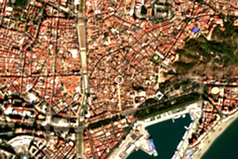
From above
Around the beach
Viewpoints
- Mirador de la Alcazaba 480 m E
- Torre Blanca 840 m E
- Mirador de Gibralfaro 860 m E
Attractions & museums
- Malaga Automobile Museum museum 80 m NE
- Museo Carmen Thyssen Málaga museum 120 m W
- OXO museum 130 m E
- Academia Malagueña de Ciencias museum 170 m E
- Catedral de Málaga museum 190 m SE
- Museo de la Semana Santa de Málaga museum 250 m N
Historic sites
- Iglesia del Sagrario monument 190 m SE
- Catedral Nuestra Señora De La Encarnación monument 260 m SE
- Alhambra , Granada monument 290 m S
- Monumento al Marques de Larios monument 360 m S
- El Cenachero Statue monument 470 m S
- Monumento a Blas Infante monument 780 m SW
Nature
- Sendero Picapedreros nature reserve 680 m SE
- Monte Gibralfaro peak 1.0 km E
- Calvario peak 1.4 km NE
Marinas
- Plaza de la Marina 320 m S
- Nuevo Palmeral Puerto Málaga 490 m SE
- Paseo de la Farola 950 m SE
- IGY Málaga Marina 990 m SE
Diving & boat hire
- Passion Bike 280 m W
- Málagabici 1 PLAZA DE LA MARINA 340 m S
- Baja Bikes Malaga 440 m S
- Bike2Malaga 440 m SW
- Málaga Bike Tours and Rentals 470 m S
- Plaza Merced 470 m NE
Campsites
- Ertheo 1.0 km E
Map
Loading map…
Data on this page
- Air temperature, rain, cloud, wind, humidity: NASA POWER climatology 2001–2020, 0.5° grid.
- Sea temperature: NOAA OISST v2.1 monthly normals 1991–2020, nearest ocean cell 11.5 km away.
- Beach outline, surface, rules and public facilities: OpenStreetMap contributors (ODbL), feature r3881069; restaurants, cafés, bars and lodging: Overture Maps places (CDLA-Permissive-2.0).
- Towns and time zone: GeoNames (CC BY 4.0). Airports: OurAirports (public domain). Sunrise and sunset: NOAA solar equations.
- Photos: Wikimedia Commons, author and licence under each image.
- Satellite view: Copernicus Sentinel-2 (ESA), scene S2C_30SUF_20251024_0_L2A.
- Orientation: OpenStreetMap land polygons (ODbL). Depth and terrain: GEBCO 2020 grid.
- Settlements: GeoNames places with 1,000+ inhabitants.
- Land cover: ESA WorldCover 2021, 10 m (CC BY 4.0).
- Search popularity: about 2.4K Google searches a month for the name (KeywordTool, October 2026).
Data compiled 2026-10-13. Something wrong? Report a data error.