Indonesia / Riau Islands
Rapang
Rapang is a beach facing north-north-west, 34.1 km west of Dabo (Riau Islands, Indonesia). The sea averages 30.2 °C in May, its warmest month, and 28.0 °C in January; it stays at 21 °C or above all year.
Average sea surface temperature by month. Current month outlined.
Month by month
November at Rapang
Beach-day index 7.1/10 · Indonesia median 7.7
| Measure | Jan | Feb | Mar | Apr | May | Jun | Jul | Aug | Sep | Oct | Nov | Dec |
|---|---|---|---|---|---|---|---|---|---|---|---|---|
| Sea °C | 28.0 °C | 28.1 °C | 28.9 °C | 29.8 °C | 30.2 °C | 30.0 °C | 29.5 °C | 29.2 °C | 29.2 °C | 29.4 °C | 29.4 °C | 28.6 °C |
| High °C | 28° | 28° | 29° | 29° | 29° | 29° | 29° | 29° | 29° | 29° | 28° | 28° |
| Low °C | 26° | 26° | 27° | 28° | 28° | 28° | 27° | 27° | 27° | 27° | 27° | 27° |
| Rain mm | 214 | 127 | 186 | 203 | 204 | 169 | 168 | 160 | 164 | 193 | 272 | 305 |
| Cloud % | 84 | 78 | 77 | 79 | 77 | 74 | 73 | 71 | 79 | 84 | 90 | 91 |
| Wind m/s | 5.3 | 5.3 | 3.7 | 2.5 | 3.0 | 3.7 | 4.2 | 4.5 | 3.8 | 2.8 | 2.7 | 4.3 |
| Daylight h | 12.1 | 12.1 | 12.1 | 12.1 | 12.1 | 12.1 | 12.1 | 12.1 | 12.1 | 12.1 | 12.1 | 12.1 |
| Record high/low | 30°/24° | 32°/25° | 32°/25° | 33°/26° | 32°/27° | 32°/26° | 31°/25° | 31°/25° | 31°/24° | 32°/26° | 32°/26° | 30°/25° |
| Beach index | 7.2 | 8.0 | 7.7 | 7.6 | 7.6 | 7.9 | 7.9 | 7.9 | 7.9 | 7.6 | 7.1 | 7.0 |
Long-term monthly averages: air from NASA POWER (2001–2020), sea from NOAA OISST (1991–2020); records are the extremes of 2001–2020. How the index works.
When to go
The beach-day index peaks in February–October; February scores 8.0/10 with highs of 28 °C, sea at 28.1 °C and 127 mm of rain.
In February that is 0.8 points above the median of the 239 beaches in Indonesia covered by this atlas.
At its warmest the water here is 1.5 °C warmer than the Indonesia median for May (28.7 °C).
Across the year the sea averages 29.2 °C, warmer than 99% of the coastal beaches in the atlas.
December is the wettest month (305 mm) and February the driest (127 mm); the yearly total is about 2,370 mm.
Daylight runs from 12.1 hours in April to 12.1 hours in January; in mid-February the sun rises at 06:13 and sets at 18:20 local time.
Orientation, sun and shore
The shore faces north-north-west (335°). Open water fills about 89% of the horizon close by, which makes it an exposed spot with water on most sides.
The sun sets over the sea in every month; in mid-June it goes down at 18:05 local time on a bearing of 293°.
Sunrise is over the sea in every month.
The opposite shore is only about 2.0 km away to the north-north-west, which keeps the water sheltered from big waves. The beach is on an island of about 788 km².
About 1 km offshore the sea is roughly 2 m deep, a shallow, gently shelving sea floor. Behind the beach the ground is about 0 m above sea level 500 m inland and 8 m at 1.5 km, a flat coastal plain.
Within 1 km, the land is 89% tree cover, 6% grassland and 4% cropland (satellite land-cover map, 2021): a largely natural setting. Water makes up 99% of that circle.
- Tree 89%
- Grass 6%
- Crop 4%
Land cover: ESA WorldCover 2021 (10 m). Orientation from OpenStreetMap land polygons sampled in 36 directions; depths and heights from the GEBCO 2020 grid (about 450 m cells), indicative only.
Rainfall reaches 305 mm in December and stays above 250 mm in November and December.
Around the beach
Islands in view
- Pulau Rapang 950 m W
- Pulau Tuma 1.6 km NW
Getting there
| Airport | Code | Distance | Direction |
|---|---|---|---|
| Raja Haji Fisabilillah International Airport Tanjung Pinang-Bintan Island | TNJ | 149 km | north |
| Hang Nadim International Airport Batam | BTH | 169 km | north |
| Singapore Changi Airport Singapore | SIN | 196 km | north |
Straight-line distances from the beach; road distance is usually 20–40% longer.
Map
Loading map…
Data on this page
- Air temperature, rain, cloud, wind, humidity: NASA POWER climatology 2001–2020, 0.5° grid.
- Sea temperature: NOAA OISST v2.1 monthly normals 1991–2020, nearest ocean cell 11.1 km away.
- Beach outline, surface, rules and public facilities: OpenStreetMap contributors (ODbL); restaurants, cafés, bars and lodging: Overture Maps places (CDLA-Permissive-2.0).
- Water body, status and length: Wikidata (CC0).
- Towns and time zone: GeoNames (CC BY 4.0). Airports: OurAirports (public domain). Sunrise and sunset: NOAA solar equations.
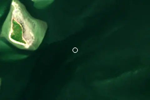
- Satellite view: Copernicus Sentinel-2 (ESA), scene S2C_48MVE_20250416_0_L2A.
- Orientation: OpenStreetMap land polygons (ODbL). Depth and terrain: GEBCO 2020 grid.
- Settlements: GeoNames places with 1,000+ inhabitants.
- Land cover: ESA WorldCover 2021, 10 m (CC BY 4.0).
Data compiled 2026-10-13. Something wrong? Report a data error.