Spain / Andalusia
Playa de Gandía
Playa de Gandía is a beach, 5.3 km west of Antequera (Andalusia, Spain). The sea averages 23.4 °C in August, its warmest month, and 15.0 °C in February; it is 21 °C or warmer in July–September.
Average sea surface temperature by month. Current month outlined.
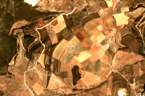
Setting
Within 1 km, the land is 55% grassland, 22% cropland and 17% tree cover (satellite land-cover map, 2021): a largely natural setting.
- Grass 55%
- Crop 22%
- Tree 17%
- Shrub 6%
Land cover: ESA WorldCover 2021 (10 m).
Facilities within 1 km
- –Restaurants, cafés & bars
- –Public toilets
- –Showers
- –Car parks
- –Lifeguard stations
Counted within 1 km of the beach (bus stops 1.5 km) from OpenStreetMap features and Overture Maps places, release of 2026-10. Unmapped does not mean absent.
Nearest services
The nearest place to eat or drink is 1.3 km east (Refectorio), the nearest grocery shop is 4.7 km north-east (Carniceria picasso), the nearest fuel station is 4.2 km north-east (Plenergy Antequera I) and the nearest pharmacy or clinic is 4.8 km east (Farmacia Mir Muñoz 12H).
| Service | Nearest mapped | Distance | Direction |
|---|---|---|---|
| Food and drink | Refectorio | 1.3 km | east |
| Groceries | Carniceria picasso | 4.7 km | north-east |
| Accommodation | Convento de la Magdalena | 1.3 km | east |
| Pharmacy or clinic | Farmacia Mir Muñoz 12H | 4.8 km | east |
| Fuel station | Plenergy Antequera I | 4.2 km | north-east |
| Car park | — | 1.5 km | east |
| Public toilets | — | 4.9 km | north-east |
| Bus stop | Bernardo Simón - Esquina Melchor Aguirre | 4.1 km | north-east |
Straight-line distance to the nearest feature within 20 km, from OpenStreetMap and Overture Maps places. A category is missing when nothing is mapped within 20 km.
Getting there
| Airport | Code | Distance | Direction |
|---|---|---|---|
| Málaga-Costa del Sol Airport Málaga | AGP | 37.8 km | south |
| F.G.L. Airport Granada-Jaén Airport Granada | GRX | 77.3 km | east |
| Córdoba Airport Córdoba | ODB | 95.3 km | north |
Straight-line distances from the beach; road distance is usually 20–40% longer.
2 towns and villages of 1,000+ people lie within 10 km (about 45.2K residents); within 30 km there are 24 (about 138.2K).
Map and nearby beaches
Loading map…
Open in OpenStreetMap · Directions in Google Maps
| Beach | Distance | Warmest sea | Length | Surface |
|---|---|---|---|---|
| Playa de Gandía | – | 23.4 °C | – | – |
| Playa de San Andrés | 34.6 km S | 23.4 °C | – | – |
| Málaga | 36.0 km SE | 23.4 °C | 1.4 km | Sand |
| Playa de La Malagueta | 36.9 km SE | 23.4 °C | 1.4 km | Sand |
| Playa de la Caleta | 37.0 km SE | 23.4 °C | 1.2 km | Sand |
| Playa de Huelin | 37.4 km SE | 23.4 °C | 741 m | – |
| Baños del Carmen | 37.9 km SE | 23.4 °C | 160 m | – |
- Playa de San Andrés34.6 km SCompare
- Málaga36.0 km SECompare
- Playa de La Malagueta36.9 km SECompare
- Playa de la Caleta37.0 km SECompare
- Playa de Huelin37.4 km SECompare
- Baños del Carmen37.9 km SECompare
- Playa de la Misericordia38.2 km SECompare
- Playa de Pedregalejo38.4 km SECompare
Data on this page
- Sea temperature: NOAA OISST v2.1 monthly normals 1991–2020, nearest ocean cell 47.4 km away.
- Beach outline, surface, rules and public facilities: OpenStreetMap contributors (ODbL); restaurants, cafés, bars and lodging: Overture Maps places (CDLA-Permissive-2.0).
- Towns and time zone: GeoNames (CC BY 4.0). Airports: OurAirports (public domain). Sunrise and sunset: NOAA solar equations.
- Satellite view: Copernicus Sentinel-2 (ESA), scene S2A_30SUG_20260805_1_L2A.
- Settlements: GeoNames places with 1,000+ inhabitants.
- Nearest services: OpenStreetMap and Overture Maps places within 20 km.
- Land cover: ESA WorldCover 2021, 10 m (CC BY 4.0).
- Search popularity: about 8.1K Google searches a month for the name (KeywordTool, October 2026).
Data compiled 2026-10-13. Something wrong? Report a data error.