Turkey / Mersin
Narlı Plajı
Narlı Plajı is a beach, 8.1 km east of Kurtuluş (Mersin, Turkey). The sea averages 28.8 °C in August, its warmest month, and 17.2 °C in February; it is 21 °C or warmer in May–November.
Average sea surface temperature by month. Current month outlined.
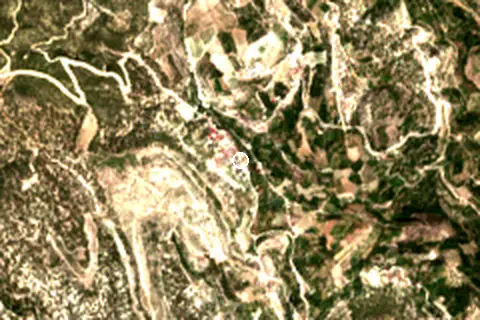
Setting
Within 1 km, the land is 63% grassland, 23% tree cover and 8% shrubland (satellite land-cover map, 2021): a largely natural setting.
- Grass 63%
- Tree 23%
- Shrub 8%
Land cover: ESA WorldCover 2021 (10 m).
Facilities within 1 km
- 1Restaurants, cafés & bars
- –Public toilets
- –Showers
- –Car parks
- –Lifeguard stations
Food and drink mapped within 1 km: 1 restaurant.
Counted within 1 km of the beach (bus stops 1.5 km) from OpenStreetMap features and Overture Maps places, release of 2026-10. Unmapped does not mean absent.
Nearest services
The nearest place to eat or drink is 0 m north (Sibel kafeterya), the nearest grocery shop is 14.9 km west (Yıldız Büfe), the nearest fuel station is 17.1 km west (Petrol Ofisi) and the nearest pharmacy or clinic is 17.3 km west (Alver Eczanesi).
| Service | Nearest mapped | Distance | Direction |
|---|---|---|---|
| Food and drink | Sibel kafeterya | 0 m | north |
| Groceries | Yıldız Büfe | 14.9 km | west |
| Accommodation | Zeyker Yaylası/Mersin | 5.9 km | west |
| Pharmacy or clinic | Alver Eczanesi | 17.3 km | west |
| Fuel station | Petrol Ofisi | 17.1 km | west |
| Car park | — | 17.6 km | west |
| Public toilets | — | 4.7 km | north-west |
| Bus stop | — | 17.7 km | west |
Straight-line distance to the nearest feature within 20 km, from OpenStreetMap and Overture Maps places. A category is missing when nothing is mapped within 20 km.
Getting there
| Airport | Code | Distance | Direction |
|---|---|---|---|
| Gazipaşa-Alanya Airport Gazipaşa | GZP | 126 km | west |
| Çukurova International Airport Tarsus | COV | 131 km | east |
| Ercan International Airport Tymbou (Kirklar) | ECN | 168 km | south |
Straight-line distances from the beach; road distance is usually 20–40% longer.
2 towns and villages of 1,000+ people lie within 10 km (about 1.1K residents); within 30 km there are 5 (about 52.3K).
Map and nearby beaches
Loading map…
Open in OpenStreetMap · Directions in Google Maps
| Beach | Distance | Warmest sea | Length | Surface |
|---|---|---|---|---|
| Narlı Plajı | – | 28.8 °C | – | – |
| Taşucu Plajı | 44.3 km SE | 28.7 °C | 757 m | – |
| Narlıkuyu Plajı | 48.7 km SE | 28.8 °C | – | – |
| Susanoğlu Plajı | 48.8 km SE | 28.8 °C | 2.4 km | – |
| Tisan Plajı | 55.9 km S | 28.6 °C | 339 m | – |
- Taşucu Plajı44.3 km SECompare
- Narlıkuyu Plajı48.7 km SECompare
- Susanoğlu Plajı48.8 km SECompare
- Tisan Plajı55.9 km SCompare
Data on this page
- Sea temperature: NOAA OISST v2.1 monthly normals 1991–2020, nearest ocean cell 54.0 km away.
- Beach outline, surface, rules and public facilities: OpenStreetMap contributors (ODbL); restaurants, cafés, bars and lodging: Overture Maps places (CDLA-Permissive-2.0).
- Towns and time zone: GeoNames (CC BY 4.0). Airports: OurAirports (public domain). Sunrise and sunset: NOAA solar equations.
- Satellite view: Copernicus Sentinel-2 (ESA), scene S2B_36SWF_20230915_0_L2A.
- Settlements: GeoNames places with 1,000+ inhabitants.
- Nearest services: OpenStreetMap and Overture Maps places within 20 km.
- Land cover: ESA WorldCover 2021, 10 m (CC BY 4.0).
- Search popularity: about 1.6K Google searches a month for the name (KeywordTool, October 2026).
Data compiled 2026-10-13. Something wrong? Report a data error.