Turkey / Hatay
Sofular Plajı
Sofular Plajı is a beach, 1.2 km east of Antakya (Hatay, Turkey). The sea averages 28.6 °C in August, its warmest month, and 17.2 °C in March; it is 21 °C or warmer in May–November.
Average sea surface temperature by month. Current month outlined.

Setting
Within 1 km, the land is 61% built-up land, 27% tree cover and 5% grassland (satellite land-cover map, 2021): an urban beach. Water makes up 1% of that circle.
- Built 61%
- Tree 27%
- Grass 5%
- Bare 4%
- Shrub 3%
Land cover: ESA WorldCover 2021 (10 m).
OpenStreetMap shows no lifeguard station within 1 km. Seasonal lifeguard posts are often unmapped, so check on site.
Photos


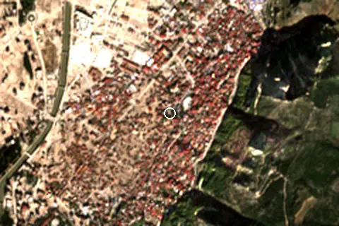
From above
Facilities within 1 km
- 242Restaurants, cafés & bars
- –Public toilets
- –Showers
- 2Drinking water
- 2Car parks
- –Lifeguard stations
- 33Hotels & guesthouses
- 33Grocery shops
- 7Pharmacies & clinics
- 1Cash machines
- 3Viewpoints
- 5Historic sites
Food and drink mapped within 1 km: 150 restaurants, 59 cafés, 15 bars and 18 fast-food outlets. Accommodation: 33 hotels and guesthouses.
Counted within 1 km of the beach (bus stops 1.5 km) from OpenStreetMap features and Overture Maps places, release of 2026-10. Unmapped does not mean absent.
Around the beach
Viewpoints
- Antakya Manzara 830 m SE
Attractions & museums
- Antakya Cam Müzesi museum 160 m NW
- Antakya Belediyesi El Sanatları Müzesi museum 490 m W
- Hatay Tıbbi Ve Aromatik Bitkiler Müzesi museum 530 m SW
- Hatay Etnoğrafya Müzesi museum 570 m N
- Necmi Asfuroğlu Antakya Müzesi museum 970 m NE
- Müze Otel museum 990 m N
Historic sites
- Tarihi Kurşunlu hanı monument 570 m W
- Atatürk anıtı monument 890 m W
- Necmi Baba Dinlenme Tesisleri monument 930 m SW
- Senpiyer. Kilisesi monument 970 m SW
- St.Pierre Kilisesi church 1.0 km NE
Nature
- Habib-i Neccar Dağı peak 880 m SE
- havuzlar parkı nature reserve 900 m S
- Antakya Habibi Nacar Sosyal Tesisleri nature reserve 970 m SW
- St.Pierre Kilisesi cave entrance 1.0 km NE
Getting there
| Airport | Code | Distance | Direction |
|---|---|---|---|
| Hatay Airport Antakya | HTY | 20.4 km | north-east |
| Latakia International Airport Latakia | LTK | 91.4 km | south |
| Aleppo International Airport Aleppo | ALP | 94.9 km | east |
Straight-line distances from the beach; road distance is usually 20–40% longer.
Local transport: 2 mapped car parks within 1 km.
15 towns and villages of 1,000+ people lie within 10 km (about 478.4K residents); within 30 km there are 39 (about 693.1K).
Map and nearby beaches
Loading map…
Open in OpenStreetMap · Directions in Google Maps
- Gözcüler Plajı30.7 km NWCompare
Data on this page
- Sea temperature: NOAA OISST v2.1 monthly normals 1991–2020, nearest ocean cell 27.9 km away.
- Beach outline, surface, rules and public facilities: OpenStreetMap contributors (ODbL); restaurants, cafés, bars and lodging: Overture Maps places (CDLA-Permissive-2.0).
- Towns and time zone: GeoNames (CC BY 4.0). Airports: OurAirports (public domain). Sunrise and sunset: NOAA solar equations.
- Photos: Wikimedia Commons, author and licence under each image.
- Satellite view: Copernicus Sentinel-2 (ESA), scene S2B_37SBA_20231121_1_L2A.
- Settlements: GeoNames places with 1,000+ inhabitants.
- Land cover: ESA WorldCover 2021, 10 m (CC BY 4.0).
- Search popularity: about 4.4K Google searches a month for the name (KeywordTool, October 2026).
Data compiled 2026-10-13. Something wrong? Report a data error.