United Kingdom / England
Tower Beach
Tower Beach is an inland beach, 1.1 km south-east of City of London (England, United Kingdom). Average daytime highs peak at 22 °C in July and drop to 7 °C in January.
Weather month by month
November at Tower Beach
Beach-day index 3.3/10 · United Kingdom median 1.8
| Measure | Jan | Feb | Mar | Apr | May | Jun | Jul | Aug | Sep | Oct | Nov | Dec |
|---|---|---|---|---|---|---|---|---|---|---|---|---|
| High °C | 7° | 7° | 10° | 14° | 17° | 20° | 22° | 22° | 19° | 15° | 10° | 7° |
| Low °C | 1° | 1° | 2° | 4° | 7° | 10° | 13° | 12° | 10° | 7° | 4° | 2° |
| Rain mm | 59 | 51 | 48 | 41 | 57 | 61 | 63 | 68 | 45 | 69 | 67 | 64 |
| Cloud % | 75 | 75 | 73 | 68 | 71 | 72 | 69 | 72 | 68 | 73 | 75 | 76 |
| Wind m/s | 5.8 | 5.7 | 5.3 | 4.6 | 4.7 | 4.3 | 4.3 | 4.4 | 4.6 | 5.2 | 5.2 | 5.5 |
| Daylight h | 8.3 | 10.0 | 11.8 | 13.8 | 15.6 | 16.6 | 16.2 | 14.7 | 12.7 | 10.8 | 8.9 | 7.9 |
| Record high/low | 13°/-8° | 17°/-7° | 19°/-5° | 25°/-4° | 27°/-0° | 29°/3° | 34°/7° | 32°/5° | 29°/3° | 27°/-4° | 18°/-5° | 14°/-6° |
| Beach index | 3.3 | 3.4 | 3.6 | 3.8 | 3.6 | 5.5 | 6.8 | 6.4 | 5.1 | 3.3 | 3.3 | 3.3 |
Long-term monthly averages: air from NASA POWER (2001–2020), sea from NOAA OISST (1991–2020); records are the extremes of 2001–2020. How the index works.
Setting
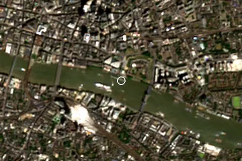
Within 1 km, the land is 91% built-up land and 8% tree cover (satellite land-cover map, 2021): an urban beach. Water makes up 14% of that circle.
- Built 91%
- Tree 8%
Land cover: ESA WorldCover 2021 (10 m).
This is not a sea beach, so no sea-temperature normals are shown.
When to go
The beach-day index peaks in July–August; July scores 6.8/10 with highs of 22 °C and 63 mm of rain.
In July that is 3.6 points above the median of the 240 beaches in United Kingdom covered by this atlas.
October is the wettest month (69 mm) and April the driest (41 mm); the yearly total is about 690 mm.
Daylight runs from 7.9 hours in December to 16.6 hours in June; in mid-July the sun rises at 04:59 and sets at 21:12 local time.
Facilities within 1 km
- 1,224Restaurants, cafés & bars
- 26Public toilets
- –Showers
- 12Drinking water
- 68Car parks
- –Lifeguard stations
- 114Hotels & guesthouses
- 139Grocery shops
- 22Water-sports spots
- 5Marinas & slipways
- 209Bus stops (1.5 km)
- 38Pharmacies & clinics
- 34Cash machines
- 27Bike rental
- 8Viewpoints
- 8Historic sites
Food and drink mapped within 1 km: 630 restaurants, 212 cafés, 329 bars and 53 fast-food outlets. Accommodation: 114 hotels and guesthouses.
Counted within 1 km of the beach (bus stops 1.5 km) from OpenStreetMap features and Overture Maps places, release of 2026-10. Unmapped does not mean absent.
Around the beach
Viewpoints
- Tower Bridge 290 m SE
- Sky Garden 550 m NW
- The Garden at 120 570 m N
- Terrace (One Leadenhall) 730 m NW
- The Lookout 830 m NW
- Horizon 22 850 m N
Attractions & museums
- The Tower’s Mint museum 100 m NE
- Torture Room museum 160 m E
- London Castle museum 200 m N
- HMS Belfast museum 210 m W
- Royal Armouries museum 210 m NE
- The Crypt Museum museum 250 m N
Historic sites
- Blood Swept Lands and Seas of Red monument 160 m NE
- Tower Hill Memorial monument 280 m N
- Albert Monument monument 390 m SW
- Monument to the Great Fire of London monument 590 m NW
- The Monument monument 610 m NW
- Winchester Palace monument 850 m W
Lighthouses & piers
- Sugar Quay Jetty pier 180 m NW
- Butlers Wharf Pier pier 490 m SE
- Tower Bridge Wharf Pier pier 710 m E
- Old Swan Pier pier 750 m W
- Downings Roads Moorings pier 830 m SE
- Garden Barge Square pier 850 m SE
Marinas
- St Catherines Dock 380 m E
- St. Katharine Docks Drawbridge and Locks 470 m E
- Marina, London 500 m E
- St Katharine Docks Marina 500 m E
- Hermitage Community Moorings 890 m SE
Diving & boat hire
- Livetts Launches 230 m SW
- Druid Cycles Cic 680 m S
- Santander Cycles 730 m S
- JGF Passenger Boats 750 m W
- TfL Santander Cycle Hire 790 m N
- The Harpy Houseboat, Tower Bridge 790 m SE
Getting there
| Airport | Code | Distance | Direction |
|---|---|---|---|
| London City Airport London | LCY | 9.3 km | east |
| London Heathrow Airport London | LHR | 26.7 km | west |
| London Gatwick Airport London | LGW | 40.5 km | south |
Straight-line distances from the beach; road distance is usually 20–40% longer.
Local transport: 209 bus stops within 1.5 km, rail station London Fenchurch Street (470 m), rail station Tower Gateway (500 m), ferry terminal Tower Millennium Pier (20 m), ferry terminal Saint Katharine's Pier (380 m) and 68 mapped car parks within 1 km.
98 towns and villages of 1,000+ people lie within 10 km (about 11.6M residents); within 30 km there are 352 (about 18.4M).
Reference
Tower Beach was an urban beach on the north bank of the River Thames in London, England, adjacent to the Tower of London, which was open to the public from 1934 to 1971.
Wikidata item Q107736832 · classified as urban beach.
When people look it up
The EN Wikipedia article was read 2,559 times in the 12 months to August 2026. Interest peaks in May (1,507 views), 24.7× the quietest month.
Map
Loading map…
Data on this page
- Air temperature, rain, cloud, wind, humidity: NASA POWER climatology 2001–2020, 0.5° grid.
- Beach outline, surface, rules and public facilities: OpenStreetMap contributors (ODbL); restaurants, cafés, bars and lodging: Overture Maps places (CDLA-Permissive-2.0).
- Water body, status and length: Wikidata (CC0).
- Towns and time zone: GeoNames (CC BY 4.0). Airports: OurAirports (public domain). Sunrise and sunset: NOAA solar equations.
- Satellite view: Copernicus Sentinel-2 (ESA), scene S2C_30UXC_20260525_0_L2A.
- Settlements: GeoNames places with 1,000+ inhabitants.
- Land cover: ESA WorldCover 2021, 10 m (CC BY 4.0).
Data compiled 2026-10-13. Something wrong? Report a data error.