United States / Oregon
Poet's Beach
Poet's Beach is a 124 m-long sandy inland beach, 1.9 km south of Portland (Oregon, United States). Average daytime highs peak at 26 °C in August and drop to 4 °C in December.

Weather month by month
November at Poet's Beach
Beach-day index 1.6/10 · United States median 3.3
| Measure | Jan | Feb | Mar | Apr | May | Jun | Jul | Aug | Sep | Oct | Nov | Dec |
|---|---|---|---|---|---|---|---|---|---|---|---|---|
| High °C | 5° | 6° | 9° | 12° | 17° | 19° | 25° | 26° | 22° | 15° | 8° | 4° |
| Low °C | -0° | -0° | 1° | 3° | 6° | 8° | 11° | 11° | 9° | 5° | 2° | -0° |
| Rain mm | 253 | 164 | 203 | 135 | 90 | 63 | 15 | 27 | 69 | 163 | 256 | 276 |
| Cloud % | 79 | 75 | 78 | 75 | 68 | 62 | 39 | 40 | 47 | 63 | 77 | 81 |
| Wind m/s | 2.4 | 2.1 | 1.9 | 1.8 | 1.6 | 1.6 | 1.6 | 1.6 | 1.6 | 1.8 | 2.2 | 2.3 |
| Daylight h | 9.1 | 10.4 | 11.8 | 13.5 | 14.9 | 15.7 | 15.4 | 14.2 | 12.6 | 11.0 | 9.6 | 8.7 |
| Record high/low | 16°/-15° | 16°/-12° | 21°/-7° | 30°/-6° | 35°/-1° | 38°/3° | 40°/6° | 40°/5° | 38°/-1° | 30°/-5° | 18°/-12° | 15°/-15° |
| Beach index | 1.6 | 2.6 | 2.1 | 2.9 | 3.4 | 5.2 | 9.3 | 9.2 | 6.9 | 2.7 | 1.6 | 1.5 |
Long-term monthly averages: air from NASA POWER (2001–2020), sea from NOAA OISST (1991–2020); records are the extremes of 2001–2020. How the index works.
Setting
Within 1 km, the land is 72% built-up land, 23% tree cover and 3% grassland (satellite land-cover map, 2021): an urban beach. Water makes up 23% of that circle.
- Built 72%
- Tree 23%
- Grass 3%
Land cover: ESA WorldCover 2021 (10 m).
This is not a sea beach, so no sea-temperature normals are shown.
When to go
The beach-day index peaks in July–August; July scores 9.3/10 with highs of 25 °C and 15 mm of rain.
In July that is 1.4 points above the median of the 2,466 beaches in United States covered by this atlas.
December is the wettest month (276 mm) and July the driest (15 mm); the yearly total is about 1,710 mm.
Daylight runs from 8.7 hours in December to 15.7 hours in June; in mid-July the sun rises at 05:35 and sets at 20:57 local time.
Facilities within 1 km
- 152Restaurants, cafés & bars
- 5Public toilets
- –Showers
- 10Drinking water
- 80Car parks
- –Lifeguard stations
- 17Hotels & guesthouses
- 15Grocery shops
- 7Water-sports spots
- 1Marinas & slipways
- 131Bus stops (1.5 km)
- 9Pharmacies & clinics
- 5Cash machines
- 13Bike rental
- 1Viewpoints
- 1Historic sites
Food and drink mapped within 1 km: 102 restaurants, 27 cafés, 12 bars and 11 fast-food outlets. Accommodation: 17 hotels and guesthouses.
Counted within 1 km of the beach (bus stops 1.5 km) from OpenStreetMap features and Overture Maps places, release of 2026-10. Unmapped does not mean absent.
Photos


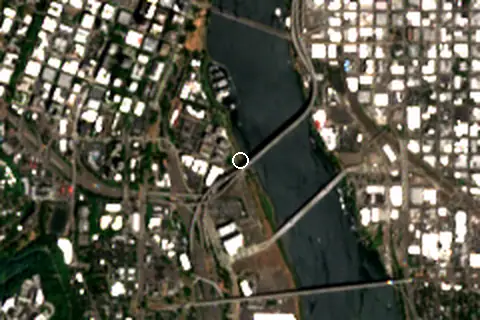
From above
Around the beach
Attractions & museums
- Omsi museum 420 m E
- Omni Science Museum Portland Oregon museum 470 m NE
- Palm Springs Zoo attraction 510 m SW
- Oregon Zoo attraction 750 m NW
- Oregon Rail Heritage Center museum 750 m E
- Tempos Circus attraction 840 m E
Historic sites
- Newberry National Volcanic Monument monument 940 m NW
Islands in view
- Ross Island 2.1 km S
Lighthouses & piers
- S pier 280 m N
- A pier 340 m N
- B pier 390 m N
- H pier 410 m N
- C pier 430 m N
- D pier 470 m N
Marinas
- Riverplace Marina 290 m N
Diving & boat hire
- Portland Electric Boat Company 270 m NW
- Yacht Tubs 340 m NW
- Sk Watercraft Rentals 670 m SE
- Biketown - SW Moody at Aerial Tram Terminal 880 m S
- Kerr Bikes Rentals 890 m N
- Kerr Bikes 910 m N
Getting there
| Airport | Code | Distance | Direction |
|---|---|---|---|
| Portland International Airport Portland | PDX | 10.7 km | north-east |
| Salem-Willamette Valley Airport/McNary Field Salem | SLE | 71.3 km | south |
| Eugene Airport Eugene | EUG | 160 km | south |
Straight-line distances from the beach; road distance is usually 20–40% longer.
Local transport: 131 bus stops within 1.5 km, rail station South Waterfront/South Moody (480 m), rail station OMSI/Southeast Water (680 m) and 80 mapped car parks within 1 km.
12 towns and villages of 1,000+ people lie within 10 km (about 784.2K residents); within 30 km there are 61 (about 1.9M).
Reference
Poet's Beach is an urban beach along the Willamette River, near Portland, Oregon's Marquam Bridge, in the United States.
Wikidata item Q38806519.
When people look it up
The EN Wikipedia article was read 1,020 times in the 12 months to August 2026. Interest peaks in May (201 views), 4.6× the quietest month.
Map and nearby beaches
Loading map…
Open in OpenStreetMap · Directions in Google Maps
| Beach | Distance | Warmest sea | Length | Surface |
|---|---|---|---|---|
| Poet's Beach | – | – | 124 m | Sand |
| Audrey McCall Beach | 600 m NE | – | – | – |
| Broughton Beach | 11.5 km NE | – | 448 m | Sand |
| Sundial Beach | 21.8 km E | – | – | – |
| Collins Beach | 33.1 km N | – | 2.2 km | Sand |
| Lyons Beach | 37.5 km N | – | – | – |
| San Salvador Beach | 42.2 km SW | – | – | – |
- Audrey McCall Beach600 m NECompare
- Broughton Beach11.5 km NECompare
- Sundial Beach21.8 km ECompare
- Collins Beach33.1 km NCompare
- Lyons Beach37.5 km NCompare
- San Salvador Beach42.2 km SWCompare
- Goble Beach59.1 km NCompare
Data on this page
- Air temperature, rain, cloud, wind, humidity: NASA POWER climatology 2001–2020, 0.5° grid.
- Beach outline, surface, rules and public facilities: OpenStreetMap contributors (ODbL), feature w471680419; restaurants, cafés, bars and lodging: Overture Maps places (CDLA-Permissive-2.0).
- Water body, status and length: Wikidata (CC0).
- Towns and time zone: GeoNames (CC BY 4.0). Airports: OurAirports (public domain). Sunrise and sunset: NOAA solar equations.
- Photos: Wikimedia Commons, author and licence under each image.
- Satellite view: Copernicus Sentinel-2 (ESA), scene S2B_10TER_20260713_0_L2A.
- Settlements: GeoNames places with 1,000+ inhabitants.
- Land cover: ESA WorldCover 2021, 10 m (CC BY 4.0).
Data compiled 2026-10-13. Something wrong? Report a data error.