Vietnam / Quảng Ninh
Bãi biển Hải Hòa
Bãi biển Hải Hòa is a beach, 10.9 km north-west of Thị Trấn Cái Rồng (Quảng Ninh, Vietnam). The sea averages 29.6 °C in August, its warmest month, and 18.9 °C in February; it is 21 °C or warmer in April–December.
Average sea surface temperature by month. Current month outlined.
Setting
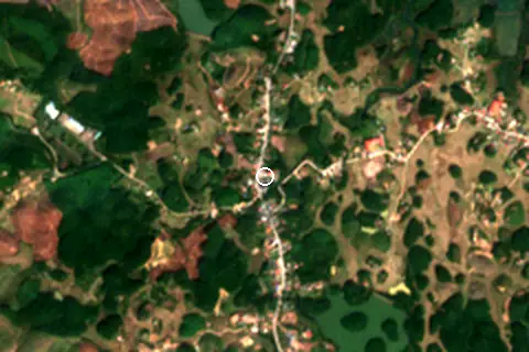
Within 1 km, the land is 73% tree cover, 21% cropland and 4% built-up land (satellite land-cover map, 2021): a largely natural setting. Water makes up 4% of that circle.
- Tree 73%
- Crop 21%
- Built 4%
- Grass 3%
Land cover: ESA WorldCover 2021 (10 m).
Nearest services
The nearest place to eat or drink is 2.4 km south (Nhà hàng Thảo Chi), the nearest grocery shop is 1.4 km south (HTX Nông Nghiệp Ngọc Linh), the nearest fuel station is 9.1 km south (Cửa Hàng Xăng Dầu Mông Dương) and the nearest pharmacy or clinic is 10.8 km south-east (Thuốc Bỏng Gia Truyền Hoàn Mơ).
| Service | Nearest mapped | Distance | Direction |
|---|---|---|---|
| Food and drink | Nhà hàng Thảo Chi | 2.4 km | south |
| Groceries | HTX Nông Nghiệp Ngọc Linh | 1.4 km | south |
| Accommodation | Sonasea Vân Đồn Harbor City | 10.9 km | south-east |
| Pharmacy or clinic | Thuốc Bỏng Gia Truyền Hoàn Mơ | 10.8 km | south-east |
| Fuel station | Cửa Hàng Xăng Dầu Mông Dương | 9.1 km | south |
| Car park | — | 7.8 km | south-east |
| Public toilets | — | 9.1 km | north |
| Bus stop | — | 11.0 km | south-east |
Straight-line distance to the nearest feature within 20 km, from OpenStreetMap and Overture Maps places. A category is missing when nothing is mapped within 20 km.
Getting there
| Airport | Code | Distance | Direction |
|---|---|---|---|
| Van Don International Airport Van Don | VDO | 7.1 km | south-east |
| Cat Bi International Airport Haiphong (Hai An) | HPH | 74.7 km | south-west |
| Noi Bai International Airport Hanoi (Soc Son) | HAN | 160 km | west |
Straight-line distances from the beach; road distance is usually 20–40% longer.
No town of 1,000+ people lies within 10 km; within 30 km there are 5 (about 372K).
Map and nearby beaches
Loading map…
Open in OpenStreetMap · Directions in Google Maps
| Beach | Distance | Warmest sea | Length | Surface |
|---|---|---|---|---|
| Bãi biển Hải Hòa | – | 29.6 °C | – | – |
| Bãi biển Đồng Châu | 32.1 km SE | 29.6 °C | 2.8 km | Sand |
| Bãi biển Khu 295 | 32.6 km SE | 29.6 °C | 2.4 km | Sand |
| Bãi biển Robinson | 34.6 km SE | 29.6 °C | 3.5 km | Sand |
| Bãi biển Bãi Cháy | 39.2 km SW | 29.6 °C | 2.9 km | – |
| Bãi biển Kỳ Co | 57.2 km SW | 29.7 °C | 132 m | Fine sand |
- Bãi biển Đồng Châu32.1 km SECompare
- Bãi biển Khu 29532.6 km SECompare
- Bãi biển Robinson34.6 km SECompare
- Bãi biển Bãi Cháy39.2 km SWCompare
- Bãi biển Kỳ Co57.2 km SWCompare
Data on this page
- Sea temperature: NOAA OISST v2.1 monthly normals 1991–2020, nearest ocean cell 28.4 km away.
- Towns and time zone: GeoNames (CC BY 4.0). Airports: OurAirports (public domain). Sunrise and sunset: NOAA solar equations.
- Satellite view: Copernicus Sentinel-2 (ESA), scene S2B_48QYJ_20230125_0_L2A.
- Settlements: GeoNames places with 1,000+ inhabitants.
- Nearest services: OpenStreetMap and Overture Maps places within 20 km.
- Land cover: ESA WorldCover 2021, 10 m (CC BY 4.0).
- Search popularity: about 14.8K Google searches a month for the name (KeywordTool, October 2026).
Data compiled 2026-10-13. Something wrong? Report a data error.